Azaguié
Azaguié | |
|---|---|
Town, sub-prefecture, and commune | |
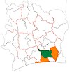
 Azaguié Location in Ivory Coast | |
| Coordinates: 5°38′N 4°5′W / 5.633°N 4.083°WCoordinates: 5°38′N 4°5′W / 5.633°N 4.083°W | |
| Country | |
| District | Lagunes |
| Region | Agnéby-Tiassa |
| Department | Agboville |
| Population (2014)[1] | |
| • Total | 21,976 |
| Time zone | UTC+0 (GMT) |

Azaguié is a town in south-eastern Ivory Coast. It is a sub-prefecture and commune of Agboville Department in Agnéby-Tiassa Region, Lagunes District. The border of Abidjan Autonomous District is three kilometres south of the town.
In 2014, the population of the sub-prefecture of Azaguié was 21,976.[2]
Villages[]
The 6 villages of the sub-prefecture of Azaguié and their population in 2014 are:[2]
- Abbé-Bégnini (2 627)
- Azaguié (13 876)
- Achiékoi (984)
- Azaguié-Makouguié (1 296)
- Azaguié-M'bromé (2 694)
- Donkoi (499)
References[]
- ^ "Côte d'Ivoire". geohive.com. Retrieved 9 December 2015.
- ^ Jump up to: a b "RGPH 2014, Répertoire des localités, Région Agnéby-Tiassa" (PDF). ins.ci. Retrieved 5 August 2019.
| show Authority control |
|---|
This Lagunes District location article is a stub. You can help Wikipedia by . |
Categories:
- Sub-prefectures of Agnéby-Tiassa
- Communes of Agnéby-Tiassa
- Lagunes District geography stubs