Bátonyterenye
Bátonyterenye | |
|---|---|
 Medieval church of | |
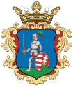
 Flag  Coat of arms | |
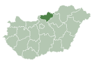
 Bátonyterenye Location of Bátonyterenye | |
| Coordinates: 47°59′26″N 19°49′51″E / 47.99060°N 19.83091°ECoordinates: 47°59′26″N 19°49′51″E / 47.99060°N 19.83091°E | |
| Country | |
| County | Nógrád |
| District | Bátonyterenye |
| Area | |
| • Total | 80.09 km2 (30.92 sq mi) |
| Population (2004) | |
| • Total | 14,240 |
| • Density | 180/km2 (460/sq mi) |
| Time zone | UTC+1 (CET) |
| • Summer (DST) | UTC+2 (CEST) |
| Postal code | 3070 |
| Area code | (+36) 32 |
| Website | www |
Bátonyterenye is a town in Nógrád county, in Northern Hungary.
Bátonyterenye was created in 1984 by the unification of the three villages of , , and . The new settlement became a town in 1989. Bátonyterenye was described as a typical socialist mining city.
Twin towns – sister cities[]
Bátonyterenye is twinned with:
References[]
- ^ "Družobné mestá". filakovo.sk (in Slovak). Fiľakovo. Retrieved 2021-04-09.
- ^ "Kardeş Şehirler". giresun.bel.tr (in Turkish). Giresun. Retrieved 2021-04-09.
- ^ "Bátonyterenye". jirkov.cz (in Czech). Město Jirkov. Retrieved 2021-04-09.
- ^ "Bátonyterenye". kobylnica.pl (in Polish). Gmina Kobylnica. Retrieved 2021-04-09.
External links[]
| Wikimedia Commons has media related to Bátonyterenye. |
- Official website in Hungarian and English
- Street map (in Hungarian)
Categories:
- Populated places in Nógrád County
- Socialist planned cities
- Planned cities in Hungary
- Nógrád geography stubs


