Böhmfeld
Böhmfeld | |
|---|---|
 Coat of arms | |
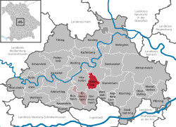
show Location of Böhmfeld within Eichstätt district | |
 Böhmfeld | |
| Coordinates: 48°52′N 11°22′E / 48.867°N 11.367°ECoordinates: 48°52′N 11°22′E / 48.867°N 11.367°E | |
| Country | Germany |
| State | Bavaria |
| Admin. region | Oberbayern |
| District | Eichstätt |
| Municipal assoc. | Eitensheim |
| Government | |
| • Mayor (2020–26) | Jürgen Nadler[1] |
| Area | |
| • Total | 16.28 km2 (6.29 sq mi) |
| Elevation | 487 m (1,598 ft) |
| Population (2020-12-31)[2] | |
| • Total | 1,704 |
| • Density | 100/km2 (270/sq mi) |
| Time zone | UTC+01:00 (CET) |
| • Summer (DST) | UTC+02:00 (CEST) |
| Postal codes | 85113 |
| Dialling codes | 08406 |
| Vehicle registration | EI |
| Website | www |


Böhmfeld is a municipality in the district of Eichstätt in Bavaria in Germany.
History[]
- 1602: About 400 people lived in Böhmfeld in 63 houses.
- School houses were built in 1777, 1839, 1892 and 1962.
- In 1806 Böhmfeld came to the newly founded Kingdom of Bavaria.
- After 1945 refugees came to Böhmfeld.[3]
Mayor[]
- 1984–2020: Alfred Ostermeier (SPD/FW)
- since 2020: Jürgen Nadler (SPD/FW)
References[]
- ^ Liste der ersten Bürgermeister/Oberbürgermeister in kreisangehörigen Gemeinden, Bayerisches Landesamt für Statistik, accessed 19 July 2021.
- ^ "Tabellenblatt "Daten 2", Statistischer Bericht A1200C 202041 Einwohnerzahlen der Gemeinden, Kreise und Regierungsbezirke". Bayerisches Landesamt für Statistik (in German). June 2021.
- ^ "Archived copy". Archived from the original on 2016-12-24. Retrieved 2020-07-10.CS1 maint: archived copy as title (link)
| Wikimedia Commons has media related to Böhmfeld. |
| show Towns and municipalities in Eichstätt (district) |
|---|
| Authority control |
|---|
This Eichstätt district location article is a stub. You can help Wikipedia by . |
Categories:
- Municipalities in Bavaria
- Eichstätt (district)
- Upper Bavaria geography stubs