Baarland
Baarland | |
|---|---|
Town | |
 Flag  Coat of arms | |
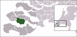 | |
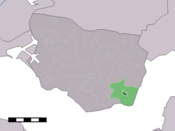 The town centre (dark green) and the statistical district (light green) of Baarland in the municipality of Borsele. | |
| Coordinates: 51°24′30″N 3°53′6″E / 51.40833°N 3.88500°ECoordinates: 51°24′30″N 3°53′6″E / 51.40833°N 3.88500°E | |
| Country | Netherlands |
| Province | Zeeland |
| Municipality | Borsele |
| Population (1 January 2010) | |
| • Total | 619 |
| Time zone | UTC+1 (CET) |
| • Summer (DST) | UTC+2 (CEST) |
| Website | baarland.borsele.net |


Protestant parish church of Sint Maarten
Baarland is a town in the Dutch province of Zeeland. It is a part of the municipality of Borsele, and lies about 21 km east of Middelburg.
In 2001, the town of Baarland had 291 inhabitants. The built-up area of the town was 0.075 km², and contained 127 residences.[1] The statistical area "Baarland", which also can include the peripheral parts of the village, as well as the surrounding countryside, has a population of around 650.[2]
Until 1970, Baarland was a separate municipality.
References[]
- ^ Statistics Netherlands (CBS), Bevolkingskernen in Nederland 2001. (Statistics are for the continuous built-up area).
- ^ Statistics Netherlands (CBS), Statline: Kerncijfers wijken en buurten 2003-2005 Archived 2006-07-24 at WebCite. As of 1 January 2005.
External links[]
- J. Kuyper, Gemeente Atlas van Nederland, 1865-1870, "Baarland". Map of the former municipality in 1868.
| Authority control |
|
|---|
This article about a location in Zeeland is a stub. You can help Wikipedia by . |
Categories:
- Populated places in Zeeland
- Former municipalities of Zeeland
- Borsele
- Zeeland geography stubs