Bagata (village)
Bagata
| |
|---|---|
Village | |
 Coat of Arms of Kurta Municipality | |
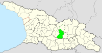
 Bagata Location of Bagata in Georgia | |
| Coordinates: 42°12′31″N 43°53′35″E / 42.20861°N 43.89306°ECoordinates: 42°12′31″N 43°53′35″E / 42.20861°N 43.89306°E | |
| Country | |
| De facto state | South Ossetia[n 1] |
| Time zone | UTC+4 (Georgian Time) |
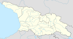

Bagata (Georgian: ბაგატა) is a settlement in the Tskhinvali District/Gori Municipality of South Ossetia,[1] Georgia.[2] It is 7 kilometers from Tskhinvali.
History[]
This Eastern Georgia village used to be in Khetagurovo Community, . In 1991 it was included in Tskhinvali District.
Geography[]
Located on . 900 meters above sea level.
See also[]
Notes[]
- ^ South Ossetia's status is disputed. It considers itself to be an independent state, but this is recognised by only a few other countries. The Georgian government and most of the world's other states consider South Ossetia de jure a part of Georgia's territory.
References[]
This Georgia location article is a stub. You can help Wikipedia by . |
This South Ossetia location article is a stub. You can help Wikipedia by . |
Categories:
- Georgia (country) geography stubs
- South Ossetia geography stubs
- Populated places in Tskhinvali District