Bagua Plateau
| Bagua Plateau | |
|---|---|
| 八卦台地 | |
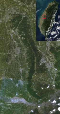 | |
 Bagua Plateau Taiwan | |
| Location | Taiwan |
| Coordinates | 23°55′58.0″N 120°37′36.7″E / 23.932778°N 120.626861°ECoordinates: 23°55′58.0″N 120°37′36.7″E / 23.932778°N 120.626861°E |
| Highest point – elevation | Mount Hengshan 442.6 m |
| Length | 32 km |
| Width | 7 km |
| Geology | Plateau |

The Pakua Plateau or Bagua Plateau (Chinese: 八卦台地; pinyin: Bāguà Táidì), also known as the Pakua Mountain Range (八卦山脈), is a plateau located in central-western Taiwan. It stretches across Changhua County and Nantou County. The plateau borders the Changhua Plain in the west and the Taichung Basin in the east. It is long and narrow, with a length of about 32 km and a width of about 4 to 7 km. The highest peak of the plateau is , which has a height of 424m.[1][2][3][4]
See also[]
References[]
- ^ "Welcome to Taiwan Tri-Mountain National Scenic Area - ..." eng.taiwan.net.tw. Archived from the original on 11 March 2014. Retrieved 11 March 2014.
- ^ "Taiwan (China) North Section of Bagua". birdlife.org. Retrieved 11 March 2014.
- ^ "Yongxing Village". taiseen.org.tw. Retrieved 11 March 2014.
- ^ "Plateaus in Asia". physicalmapofasia.com. Retrieved 11 March 2014.
| Wikimedia Commons has media related to Bagua Plateau. |
Topography of Taiwan | ||
|---|---|---|
| Mountain ranges |
|  |
| Plateaus and hill lands | ||
| Plains | ||
| Basins | ||
| Volcano groups | ||
* The place names listed above are mainly romanized as Wade–Giles that used in most of academic articles. | ||
This article about a location in Taiwan is a stub. You can help Wikipedia by . |
Categories:
- Plateaus of Taiwan
- Landforms of Changhua County
- Landforms of Nantou County
- Taiwan geography stubs