Bahawalnagar
Bahawalnagar
بہاولنگر | |
|---|---|
City | |
   From top, left to right: Govt post graduate college, Bahawalnagar Junction railway station, Mustard fields | |
 Municipal Committee logo | |
 Bahawalnagar Location of Bahawalnagar | |
| Coordinates: 29°59′34″N 73°15′13″E / 29.99278°N 73.25361°ECoordinates: 29°59′34″N 73°15′13″E / 29.99278°N 73.25361°E | |
| Country | |
| Province | |
| Division | Bahawalpur |
| District | Bahawalnagar |
| Union councils | 118 |
| Government | |
| • Type | Municipal Committee |
| • Chairman | vacant |
| • Vice Chairman | vacant |
| Elevation | 163 m (535 ft) |
| Population | |
| • City | 161,033 |
| • Rank | 54th, Pakistan |
| Time zone | UTC+5 (PST) |
| • Summer (DST) | +6 |
| Website | Municipal Committee Bahawalnagar |


Bahawalnagar (Punjabi, Urdu: بہاولنگر), is the capital city of Bahawalnagar District situated in the south east region in the Punjab province of Pakistan. The city of Bahawalnagar is the headquarter of the district and tehsil as well.[3] It is the 54th largest city of Pakistan by population according to the 2017 census.. Old name of Bahawalnagar was Rojanwali/Ubbha. It was named Bahawalnagar in 1904 after Bahawal Khan V, the ruler of the Bahawalpur state comprising the present districts of Bahawalpur, Bahawalnagar and Rahim Yar Khan.[4] It is 192 miles south of Lahore and about 120 miles east of Bahwalpur. River Sutlej passes on the northern side at a distance of about 6 miles.[5]
History[]
Bahawalnagar originally known as Rojhanwali[6] was a small settlement consisting of few huts and shacks. This village Rojhanwali is still in existence at a distance of about 1.5 miles north of the Railway Station. In the year 1895, a railway station was established and was named as Rojhanwali Railway Station. It was a junction between Bahawalnagar and Bhatinda at distance of 113 miles, now linking branch lines Amrooka and Fort Abbas. Before partition it was very busy junction. Trains used to run from Karachi to Delhi and vice versa via Bahawalnagar. Passenger trains also used to run from Bahawalnagar to Fazilka, Ferozpur. There was a loco shed and two institutes meant for recreation.[5]
In 1904 when Nawab Mohammad Bahawal Khan Abbasi IV,[7] who originally ruled over Bahawalpur State visited Rojhanwali the people asked that with His permission they want to rename the city on the name of Nawab, The Nawab allowed them with pleasure and since then the city is named as Bahawalnagar. With the advent of railways, 40–50 shops with a population of 100 dwelling units developed at existing railway bazar. Though this site was not fit for flourishing as the topographical features were not favorable and drinking water was unfit for health. With the introduction of canal system, it has become fertile area. The real achievement was Fordwah Canal which brought almost the entire district under the command of irrigation system. The town developed as colony town south of railway station.[5]
In the year 1900–1901, first police station post was established and in 1902–1903 the first primary school was established. In the year 1906 a panchayat committee consisting of nominated members was composed. 1914 Bahawalnagar was recommended as Tehsil and the police post Jweka was shifted to Bahawalnagar. A regular municipal committee was constituted in year 1922 along with many members. The Assistant Commissioner and Tehsildar were then appointed as Mir Majlis and Naib Mir Majlis.[5]
Education[]

The literacy rate of Bahawalnagar is less than 25% and unemployment rate is much higher than 25%.[8] As the literacy rate of this city is not quite enough but the government owned institutions are offering their services to increase the literacy rate. The sub-Campus of Islamia University[9] is also located in Bahawalnagar.
Sports ground[]
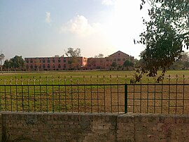
Haider Stadium is the biggest stadium of Bahawalnagar City as well as Bahawalnagar District.[10] Bahawalnagar Gymnasium is also established whiched include tennis court, and a beautiful Gym where citizen can obtain membership very easily.
Demographics[]
The population of the Bahawalnagar MC, according to the 2017 Census of Pakistan, was 2,981,919 Punjab, Pakistan.
Administration[]
Bahawalnagar is the administrative center of Bahawalnagar District, one of the five tehsils or subdivisions of the district, the tehsil is subdivided into 31 Union Councils.
Climate[]
Bahawalnagar has a semi-arid climate (Köppen climate classification BWh) with very hot summers and mild winters. Precipitation mostly falls in the monsoon season from June to August, although some rain also falls from February to April. Over the years, global climate change has affected Bahawalnagar as well as any other place on Earth and below comparison charts from Weatherbase and NOAA show the difference in rainfall and low temperatures between 1990 and 2015. The monsoon rains can be heavy and may cause floodings. Westerly waves can cause heavy rainfall and hail from November to May. Tornadoes are very rare.
| hideClimate data for Bahawalnagar, Pakistan | |||||||||||||
|---|---|---|---|---|---|---|---|---|---|---|---|---|---|
| Month | Jan | Feb | Mar | Apr | May | Jun | Jul | Aug | Sep | Oct | Nov | Dec | Year |
| Average high °C (°F) | 20 (68) |
23 (73) |
29 (84) |
36 (96) |
40 (104) |
41 (105) |
38 (100) |
37 (98) |
36 (96) |
34 (93) |
28 (82) |
22 (71) |
32 (89) |
| Average low °C (°F) | 4 (39) |
7 (44) |
11 (55) |
17 (66) |
22 (73) |
26.9 (82) |
27 (80) |
27 (80) |
24 (75) |
17 (62) |
11 (51) |
6 (42) |
17 (62) |
| Average precipitation mm (inches) | 18 (0.7) |
8 (0.3) |
21 (0.8) |
3 (0.1) |
8 (0.3) |
19 (0.8) |
92 (3.6) |
75 (2.9) |
35 (1.4) |
— | 5 (0.2) |
1 (0.0) |
28.5 (11.1) |
| Source: Weatherbase 2015[11] | |||||||||||||
| hideClimate data for Bahawalnagar | |||||||||||||
|---|---|---|---|---|---|---|---|---|---|---|---|---|---|
| Month | Jan | Feb | Mar | Apr | May | Jun | Jul | Aug | Sep | Oct | Nov | Dec | Year |
| Record high °C (°F) | 29.3 (84.7) |
35.6 (96.1) |
39.4 (102.9) |
45.6 (114.1) |
48.0 (118.4) |
50.1 (122.2) |
46.0 (114.8) |
42.4 (108.3) |
42.0 (107.6) |
40.0 (104.0) |
37.0 (98.6) |
29.6 (85.3) |
50.1 (122.2) |
| Average high °C (°F) | 18.6 (65.5) |
19.76 (67.57) |
26.3 (79.3) |
33.9 (93.0) |
38.8 (101.8) |
40.7 (105.3) |
36.3 (97.3) |
35.4 (95.7) |
35.5 (95.9) |
33.2 (91.8) |
25.6 (78.1) |
20.5 (68.9) |
30.38 (86.68) |
| Daily mean °C (°F) | 13.3 (55.9) |
15.7 (60.3) |
21.0 (69.8) |
28.0 (82.4) |
32.8 (91.0) |
35.1 (95.2) |
33.1 (91.6) |
32.4 (90.3) |
30.6 (87.1) |
26.4 (79.5) |
20.6 (69.1) |
15.0 (59.0) |
25.3 (77.6) |
| Average low °C (°F) | 3.8 (38.8) |
5.4 (41.7) |
9.5 (49.1) |
17.0 (62.6) |
22.7 (72.9) |
26.2 (79.2) |
26.7 (80.1) |
26.4 (79.5) |
22.7 (72.9) |
16 (61) |
9.6 (49.3) |
6.6 (43.9) |
16.1 (60.9) |
| Record low °C (°F) | 0.0 (32.0) |
−1.0 (30.2) |
3.9 (39.0) |
12.6 (54.7) |
14.4 (57.9) |
18.3 (64.9) |
16.1 (61.0) |
21.4 (70.5) |
13.1 (55.6) |
11.0 (51.8) |
4.0 (39.2) |
1.7 (35.1) |
−1.0 (30.2) |
| Average precipitation mm (inches) | 14.5 (0.57) |
26.5 (1.04) |
60.2 (2.37) |
45.2 (1.78) |
4.8 (0.19) |
45.3 (1.78) |
202.2 (7.96) |
130.9 (5.15) |
59.5 (2.34) |
1.0 (0.04) |
4.3 (0.17) |
5.0 (0.20) |
599.4 (23.59) |
| Mean monthly sunshine hours | 222.4 | 218.9 | 250.8 | 274.3 | 269.1 | 213.9 | 218.3 | 256.6 | 279.3 | 284.0 | 260.8 | 223.5 | 2,971.9 |
| Source: NOAA (1971–1990)[12] | |||||||||||||
See also[]
References[]
- ^ "Municipal Committee Bahawalnagar: Administrative Setup". Local Government Punjab. Retrieved 2018-04-24.
- ^ "POPULATION AND HOUSEHOLD DETAIL FROM BLOCK TO DISTRICT LEVEL: PUNJAB (BAHAWALNAGAR DISTRICT)" (PDF). Pakistan Bureau of Statistics. 2018-01-03. Archived from the original (PDF) on 2018-04-25. Retrieved 2018-04-24.
- ^ Tehsils & Unions in the District of Bahawalnagar – Government of Pakistan Archived 2012-02-09 at the Wayback Machine
- ^ "Archived copy". Archived from the original on 2017-04-21. Retrieved 2017-04-20.CS1 maint: archived copy as title (link)
- ^ Jump up to: a b c d Bahawalnagar – Outline Development Plan, Govt of Punjab, 1978. Accessed 2017-02-24.
- ^ Nadīm, Fārūq (2005). Chaos: Research Articles on History and Socio Economic Situation of Pakistani Punjab. World Institute of Literature & Culture. Archived from the original on 22 April 2017. Retrieved 21 April 2017.
- ^ Bahawalpur (princely state)
- ^ "Archived copy". Archived from the original on 2016-02-08. Retrieved 2015-06-07.CS1 maint: archived copy as title (link)
- ^ "The Islamia University of Bahawalpur Pakistan – Department". iub.edu.pk. Archived from the original on 28 July 2016. Retrieved 23 March 2016.
- ^ "Pakistan Cricket – 'our cricket' website". pcboard.com.pk. Archived from the original on 5 April 2016. Retrieved 23 March 2016.
- ^ "Weatherbase: Historical Weather for Bahawalnagar, Pakistan". Weatherbase. 2015. Archived from the original on 2015-09-22.
- ^ "Bahawalnagar Climate Normals 1971–1990". National Oceanic and Atmospheric Administration. Retrieved January 16, 2013.
Bibliography[]
- Economic & Industrial Publications (1990), Economic Review, Volume 21, The University of Michigan
- Pattan Development Organization (2006), Working paper understanding the role of political dynasties: Local Government Election 2005, The University of Michigan
External links[]
| Wikivoyage has a travel guide for Punjab (Pakistan). |
| show Authority control |
|---|
- Populated places in Bahawalnagar District
- Cities in Punjab (Pakistan)