Bailieborough
Bailieborough
Coill an Chollaigh | |
|---|---|
Town | |
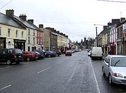 Main Street | |
 Bailieborough Location in Ireland | |
| Coordinates: 53°55′01″N 6°58′15″W / 53.916885°N 6.970875°WCoordinates: 53°55′01″N 6°58′15″W / 53.916885°N 6.970875°W | |
| Country | Ireland |
| Province | Ulster |
| County | County Cavan |
| Population (2016)[1] | 2,683 |
| Time zone | UTC±0 (WET) |
| • Summer (DST) | UTC+1 (IST) |
| Eircode routing key | A82 |
| Telephone area code | +353(0)42 |
| Irish Grid Reference | N676968 |
| Website | bailieborough |

Bailieborough or Bailieboro (/ˈbeɪlibərə/; Irish: Coill an Chollaigh, meaning 'the wood of the boar')[2] is a town in County Cavan, Ireland. As of 2016, its population was 2,683.[1] Bailieborough's proximity to the N3 National Road has made it a commuter town.
History[]
Plantation[]
Before the Plantation of Ulster, the area covered by the town was known as Killechally, Killycolly and Killycollie (Irish: Coill an Chollaigh[2]). The modern town was founded by William Bailie, a Scottish planter who was granted the lands of Tonergie (Tandragee) in East Breifne by James I, the King of England. This area was known as the Barony of Clankee, later known as Bailieburrow.
The conditions of being granted these lands were that within 2 years Bailie had to have constructed a house and bawn for himself, along with building tenant houses so he could collect revenue in the form of rent. An annuity would have to be paid to the English monarch, this annuity would also be reduced if Bailie gave preference to settling Scottish people on his land. Included in his duties of planting the area, he had to ensure that there were blunderbusses and muskets available so he could arm his men to defend the new plantation. Finally, he was obliged to take an Oath of supremacy to the English monarch as the Supreme Governor of the Church of England and the undisputed English monarch.
By 1613, Bailie had constructed a house for himself known as 'Manor of Bailieburrow'. It was situated in a demesne that is today known as Castle Lake Forest. The town continued to develop and in 1626 a report recorded that the town name was now Bailieborough, which it has maintained to this day. Originally, a number of thatched houses had developed around the gates of the castle but this was deemed unsightly and it was decided that the settlement would be moved. Thus, Bailieborough moved to where the current old Church of Ireland chapel is located in the town. This remains the town's location.
In 1685, ownership of the estate was passed to a Scottish man known as Hamilton, who then sold the estate to a man called Colonel Stewart. The estate changed hands again when it was sold to Stewart Corry, a landowner from Rockcorry and a member of the Corry family. Leading up to the 1798 Rebellion, the castle grounds were used for training by rebels. Today, a memorial to the rebels stands at the foot of 'Rebel Hill' in the castle grounds. In 1814, the estate was sold to Sir William Young who had returned from travels in the East Indies. Young is responsible for the current design of the town, with the Main Street design being attributed to him.
Rapid development[]
The 1800s saw the rapid development of the town. The courthouse in the town was erected in 1817, with the Bridewell Jail being opened in 1833. The courthouse is no longer in use for its original design and is now a community hall. In 1833, work began on a new Church of Ireland church located at the bottom of the town. It was completed in 1875 when the bell was erected in the Belfry. The church replaced the old Protestant church located in the estate of Woodview, which now lies in ruin. A new Catholic church was constructed in 1839, with Phillip O'Reilly as the parish priest at the time. It replaced an old thatched chapel that had stood since the 1700s. The bell tower was constructed in 1851, while between 1868 and 1870 the chancel, baptistery and sacristy were erected. The marble altar located in the church has been located in the church since 24 December 1895. The Stations of the Cross inside the church were painted by George Collie, an Irish artist in 1956.[3]
The house was damaged by fire in 1918 and eventually completely demolished in the late 1930s.
Schools[]
The town has a secondary school, Bailieborough Community School, which is the only second-level institution in the town. It is adjacent to the local Catholic church, one of the churches serving the parish of .[4][5] There are two primary schools in the town: St Anne's Primary School and The Model School.
Transport[]
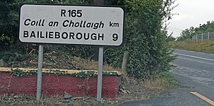
Dublin is just over an hour driving time by the nearby M3 motorway via Kells. Bailieborough is at the meeting-point of regional roads R165, R178 and R191.
Bus Éireann route 108 provides service to Kells with onward connections to Dublin and Dublin Airport. Route 166 provides service to Cavan and Dundalk.[6]
Sport[]
The local Gaelic football club is Bailieboro Shamrocks. Their home ground is at St Anne's Park and the club has won five Cavan Senior Football championships.
Surrounding areas[]
Points of interest in the surrounding area include a scenic vantage point over Lough an Lae, the scenery and nature of castle lake and town lake (situated within the town), and the parishes of Killan and Knockbride.
People[]
- William Bailie (died 1664), Bishop of Clonfert and Kilmacduagh.
- Edward Frederick Clarke (1850–1905), Mayor of Toronto.
- Shane Codd (born 1997), music producer and DJ.
- John B. Cosgrave (born 1946), mathematician and number theorist.
- Mick Finnegan, President of the Workers' Party of Ireland.
- James Kelly (1929-2003).
- Tom MacIntyre (1931–2019), poet and playwright.
- T. P. McKenna (1929-2011), actor and director.
- Joe O'Reilly (born 1955), Fine Gael Senator, Leas-Chathaoirleach of the Seanad and former TD.
- James Owens (1827–1901), recipient of the Victoria Cross.
- Francis Sheehy-Skeffington (1878–1916), suffragist, pacifist and writer.
- Cillian Sheridan (born 1989), association football player.
- Patrick Smith (1901–1977), Fianna Fáil politician and government minister.
- Niamh Smyth (born 1978), Fianna Fáil politician and grandniece of Patrick Smith.
- John Young, 1st Baron Lisgar (1807–1876), died at Lisgar House, known now as Bailieborough Castle.
See also[]
- Bailieborough Castle
- List of towns and villages in Ireland
- Market Houses in Ireland
- County Cavan
External links[]
| Wikivoyage has a travel guide for Bailieborough. |
| Wikimedia Commons has media related to Bailieborough. |
References[]
- ^ Jump up to: a b "Census 2016 Sapmap Area: Settlements Bailieborough". Central Statistics Office (Ireland). Retrieved 18 January 2019.
- ^ Jump up to: a b "Coill an Chollaigh/Bailieborough". Placenames Database of Ireland. Government of Ireland - Department of Arts, Heritage and the Gaeltacht and Dublin City University. Retrieved 16 January 2019.
- ^ "A Rich History – Bailieborough.com | Community Information & Local News". bailieborough.com. Retrieved 3 November 2019.
- ^ "Killann Parish". www.killannparish.ie. Retrieved 3 November 2019.
- ^ "Bailieborough Community School". Retrieved 3 November 2019.
- ^ "Regional Services by County". Bus Éireann. Retrieved 18 January 2019.
| show Places in County Cavan |
|---|

| show Authority control |
|---|
- Towns and villages in County Cavan
- Civil parishes of County Cavan