Bakhuta
Bakhuta
ბახუტა, Бахутæ | |
|---|---|
Village | |
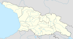 Bakhuta Location of Bakhuta village | |
| Coordinates: 42°24′41″N 43°50′58″E / 42.41139°N 43.84944°ECoordinates: 42°24′41″N 43°50′58″E / 42.41139°N 43.84944°E | |
| Country | Georgia |
| Disputed territory | South Ossetia |
| Mkhare | Shida Kartli |
| Municipality | Java |
| Community | Mskhlebi |
| Elevation | 1,280 m (4,200 ft) |
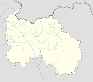

Bakhuta (Georgian: ბახუტა, Ossetian: Бахутæ) is a highland village in Georgia's Russian-occupied territory of South Ossetia/Tskhinvali Region.[1][2] It is located on the left bank of the river , to the south from Java Range, on the western slopes of Raro Mountain in the Java Municipality, Shida Kartli region. Distance to the municipal center Java is 20 km.[3] The village is surrounded by Fir, Spruce-beech and Fir-beech mixed forests.[4]
References[]
- ^ "ბახუტა". National Parliamentary Library of Georgia. Retrieved 25 November 2018.
- ^ "საქართველოს კანონი მაღალმთიანი რეგიონების სოციალურ-ეკონომიკური და კულტურული განვითარების შესახებ". Legislative Herald of Georgia. Retrieved 25 November 2018.
- ^ "ბახუტა" [Bakhuta]. Georgian Soviet Encyclopedia (in Georgian). Vol. 2. Tbilisi. 1977. p. 256.
- ^ "25 000 Topographic Map of Georgia". National Agency of Public Registry. Retrieved 25 November 2018.
Settlements in Java Municipality | ||
|---|---|---|
| Towns | 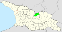 | |
| Villages | ||
This Georgia location article is a stub. You can help Wikipedia by . |
Categories:
- Mskhlebi Community villages
- Georgia (country) geography stubs