Balgale Parish
Balgale Parish | |
|---|---|
parish of Latvia | |
 Flag  Coat of arms | |
 | |
| Country | Latvia |
| Area | |
| • Total | 74.79 km2 (28.88 sq mi) |
| • Land | 73.4 km2 (28.3 sq mi) |
| • Water | 1.39 km2 (0.54 sq mi) |
| Population (1 January 2021)[2] | |
| • Total | 774 |
| • Density | 10/km2 (27/sq mi) |

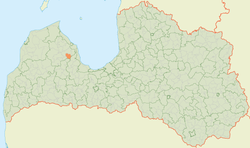
Balgale Parish (Latvian: Balgales pagasts) is an administrative unit of Talsi Municipality, Latvia.
Towns, villages and settlements of Balgale parish[]
- – parish administrative center
Notable people[]
See also[]
References[]
- ^ https://data.stat.gov.lv/pxweb/lv/OSP_PUB/START__ENV__DR__DRT/DRT010/; Central Statistical Bureau of Latvia; retrieved: 26 February 2021.
- ^ https://data.stat.gov.lv/pxweb/lv/OSP_PUB/START__POP__IR__IRS/IRD060/; Central Statistical Bureau of Latvia; retrieved: 15 June 2021.
Coordinates: 57°10′58″N 22°52′27″E / 57.18278°N 22.87417°E
This Courland location article is a stub. You can help Wikipedia by . |
Categories:
- Parishes of Latvia
- Talsi Municipality
- Courland geography stubs