Ballon d'Alsace
| Ballon d'Alsace | |
|---|---|
 | |
| Highest point | |
| Elevation | 1,247 m (4,091 ft) |
| Prominence | 217 m (712 ft)[citation needed] |
| Isolation | 562 km (349 mi) |
| Coordinates | 47°49′20″N 6°50′43″E / 47.82222°N 6.84528°ECoordinates: 47°49′20″N 6°50′43″E / 47.82222°N 6.84528°E |
| Geography | |
 Ballon d'Alsace | |
| Parent range | Vosges |

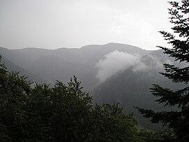
The Ballon d'Alsace German: Elsässer Belchen (el. 1247 m.), sometimes also called the Alsatian Belchen to distinguish it from other mountains named "Belchen"[1][2][3] is a mountain at the border of Alsace, Lorraine, and Franche-Comté. From its top, views include the Vosges, the Rhine valley, the Black Forest, and the Alps.
A road leads over a pass near the peak at the Col du Ballon d'Alsace, 1,171 m (3,842 ft). The pass is noted as the site of the first official mountain climb in the Tour de France on 11 July 1905,[4] the first rider to the top of the climb being René Pottier and the stage being won by Hippolyte Aucouturier. Stage 9 of the 2005 Tour crossed this pass on the centenary of the original climb.
Ballon d'Alsace features Alpine and Cross Country skiing tracks.
The mountain is part of the so-called Belchen System, a group of mountains with the name "Belchen" (in German) that may have been part of a Celtic sun calendar.
Gallery[]

Statue of Jeanne d'Arc at Ballon d'Alsace

Deminers monument at Ballon d'Alsace


See also[]
References[]
- ^ Herbertson, Andrew John, A Handbook of Geography: Volume I. General Geography. The British Isles and Europe, London: T. Nelson (1912), p. 173.
- ^ Karfeld, Kurt, Peter; Walter Dirks and Manfred Hausmann, Germany in Colour, Karfeld Verlag, 1956, p. 16.
- ^ Schickele, Rene, Heart of Alsace, AA Knopf (1929), p. 164.
- ^ "L'HISTOIRE 1903-2008" (PDF) (in French). Archived from the original (pdf) on 5 June 2011. Retrieved 5 May 2011.
External links[]
| Wikimedia Commons has media related to Ballon d'Alsace. |
| Authority control |
|---|
- Mountains of the Vosges
- One-thousanders of France
- Mountains of Vosges (department)
- Mountains of Haut-Rhin
- Mountains of the Territoire de Belfort
- Mountains of Haute-Saône