Bang Phrom subdistrict, Bangkok
Bang Phrom
บางพรม | |
|---|---|
Khwaeng | |
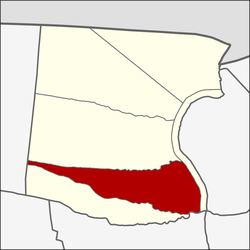 Location in Taling Chan District | |
| Country | |
| Province | Bangkok |
| Khet | Taling Chan |
| Area | |
| • Total | 4.253 km2 (1.642 sq mi) |
| Population (2020) | |
| • Total | 13,553 |
| Time zone | UTC+7 (ICT) |
| Postal code | 10170 |
| TIS 1099 | 101904 |
Bang Phrom (Thai: บางพรม, pronounced [bāːŋ pʰrōm]) is a khwaeng (subdistrict) of Taling Chan district, Bangkok's Thonburi side.
History[]
It is named after Khlong Bang Phrom, a khlong (canal) that currents through the northern area and a dividing line between its area with neighbouring Bang Ramat.
In the past, Bang Phrom used to be a rice planting area and there was a wide area extending to neighbouring subdistricts such as Bang Ramat. Local farmers therefore respect Phosop (goddess of rice) and there was a shrine dedicated to her which still exists today inside Wat Siri Watthanaram where confluence of three khlongs Bang Phrom, Lat Ta Niao, and Latmayom. Also in those day, they will have a ceremony to invite the Phosop statue procession to the various khlongs in Taling Chan at around 09.00 am. Then brought up to be enshrined in a local temple and have a complete celebration all night. Later the next day, therefore back by passing Khlong Bang Chueak Nang.
Her original statue is rumored to be gold. It has been stolen by three men from outside the area circa the late 1970s until today, this original statue is not found.
Most mill owners in this area are Chinese.
What is a pity that at present Bang Phrom do not have rice fields anymore. In which the last rice fields were dissolved around 1983.
In the year 1940, Bang Phrom consists of 20 mubans (village).[2]
It contained 15 administrative villages[3] until the dissolution of administrative villages in the area of Bangkok.
Geography[]
Bang Phrom can be considered as the southeast part of the district, with a total area of 4.253 km2 (1.642 mi2).
Neighbouring subdistricts are (from north clockwise): Bang Ramat and Khlong Chak Phra in its district, Khuha Sawan of Phasi Charoen district, Bang Chueak Nang in its district, and Thawi Watthana of Thawi Watthana district, respectively.[4]
Like other areas of Taling Chan, Bang Phrom is filled with many ancient temples and agricultural areas.[2] In which there are a total of 1,182 rai (467.1 acres) of agricultural land.[3]
Bang Phrom is an area that is easily accessible from Soi Charan Sanit Wong 35 in Bang Khun Si subdistrict, Bangkok Noi district and also consists of many roads.[3]
The eponymous Khlong Bang Phrom is a main watercourse of the area. It started in the eastern side of the area, at the mouth of the course is the location of two temples that are paired together, Wat Ratchada Thisathan Ratchaworawihan (Wat Ngoen) and the opposite side Wat Kanchana Singhat (Wat Thong – situated in the Khlong Chak Phra subdistrict), then current continuously as far as Thawi Watthana area.
Places[]
- Wat Krachom Thong
- Wat Kaeo
- Wat Thep Phon
- Wat Pak Nam Fang Nuea
- Wat Prasat
- Wat Phleng (Klang Suan)
- Wat Ratchada Thisathan Ratchaworawihan (Wat Ngoen)
- Wat Siri Watthanaram
- Wat Saphan
- Wat Saphan Floating Market
- Ratchaphruek Road
- Phran Nok–Phutthamonthon Sai 4 Road
- KIP Complex[2][4]
References[]
- ^ Administrative Strategy Division, Strategy and Evaluation Department, Bangkok Metropolitan Administration (2021). สถิติกรุงเทพมหานครประจำปี 2563 [Bangkok Statistics 2020] (PDF) (in Thai). Retrieved 27 November 2021.
{{cite web}}: CS1 maint: multiple names: authors list (link) - ^ a b c Thongdaeng, Wityada; Thongpan, Saran (September 2012). ชุมทางตลิ่งชัน ย่านเก่า [ก่อน] กรุงเทพฯ [Taling Chan junction old neighbourhood [before] Bangkok] (in Thai). Bangkok: Muang Boran Journal. pp. 188–216. ISBN 978-974-7727-93-7.
- ^ a b c "ข้อมูลแขวงบางพรม เขตตลิ่งชัน กรุงเทพมหานคร" [Information of Bang Phrom subdistrict, Taling Chan district, Bangkok]. ThaiTambon.com (in Thai).
- ^ a b "แขวงบางพรม เขตตลิ่งชัน กรุงเทพมหานคร" [Bang Phrom subdistrict, Taling Chan district, Bangkok]. Google Maps (in Thai).
Coordinates: 13°45′08.0″N 100°26′30.4″E / 13.752222°N 100.441778°E

- Taling Chan District
- Subdistricts of Bangkok