Bantry Aerodrome
This article needs additional citations for verification. (June 2021) |
Bantry Aerodrome Aeradróm Bheanntraí | |||||||||||
|---|---|---|---|---|---|---|---|---|---|---|---|
 | |||||||||||
| Summary | |||||||||||
| Airport type | Private | ||||||||||
| Operator | ROWA Pharmaceuticals Ltd | ||||||||||
| Location | Bantry | ||||||||||
| Elevation AMSL | 7 ft / 2 m | ||||||||||
| Coordinates | 51°40′08″N 009°29′04″W / 51.66889°N 9.48444°WCoordinates: 51°40′08″N 009°29′04″W / 51.66889°N 9.48444°W | ||||||||||
| Map | |||||||||||
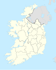 BYT Location of airport in Ireland | |||||||||||
| Runways | |||||||||||
| |||||||||||

Bantry Aerodrome is a small and privately owned airfield 1.5 NM (2.8 km; 1.7 mi) west south-west[1] of Bantry in County Cork, Ireland. The landing strip is near the coast, both runway ends are less than hundred metres away from the water.
The landing strip was constructed in the 1970s by the Rowa Pharmaceutical Corporation.[2]
The nearest international airports are Cork Airport to the West, and Kerry Airport in Farranfore, County Kerry to the North.
References[]
- ^ a b Aerodrome Information - VFR Aerodromes and Heliports Archived 15 June 2011 at the Wayback Machine
- ^ Smyth, Bryan. "DID YOU KNOW: A Pharmaceutical company owns a private airstrip in Bantry, West Cork". TheCork.ie. Retrieved 5 October 2021.
Airports in Ireland | ||||||
|---|---|---|---|---|---|---|
| Northern Ireland |
|  | ||||
| Republic of Ireland (Statistics) |
| |||||
Smaller airports handling domestic, charter or private services only. | ||||||
This article about a European airport is a stub. You can help Wikipedia by . |
This article about an Irish building or structure is a stub. You can help Wikipedia by . |
This article about transport in Ireland is a stub. You can help Wikipedia by . |
Categories:
- Airports in the Republic of Ireland
- Transport in County Cork
- Bantry
- European airport stubs
- Irish building and structure stubs
- Ireland transport stubs