Banzare Coast
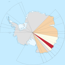
Location of Banzare Coast (red) in Wilkes Land, Australian Antarctic Territory.
Banzare Coast (67°S 126°E / 67°S 126°ECoordinates: 67°S 126°E / 67°S 126°E), part of Wilkes Land, is that portion of the coast of Antarctica lying between Cape Southard, at 122°05′E, and Cape Morse, at 130°10′E.
 WikiMiniAtlas
This coast was spotted by the US Exploring Expedition in Feb. 1840.[1]
It was seen from the air by the British-Australian-New Zealand Antarctic Research Expedition, in 1930–1931, led by Douglas Mawson. The name by Mawson is an acronym of the expedition title.
References[]
- ^ Stanton, William (1975). The Great United States Exploring Expedition. Berkeley: University of California Press. pp. 175. ISBN 0520025571.
 This article incorporates public domain material from the United States Geological Survey document: "Banzare Coast". (content from the Geographic Names Information System)
This Wilkes Land location article is a stub. You can help Wikipedia by . |
Categories:
- Coasts of Antarctica
- Landforms of Wilkes Land
- Wilkes Land geography stubs