Bath bus station
Bath bus station | |
|---|---|
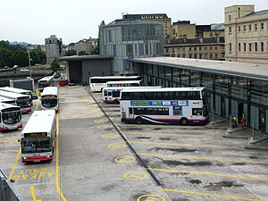 The bus station in 2010 | |
| Location | Dorchester Street, Bath, Somerset Bath and North East Somerset |
| Coordinates | 51°22′43″N 2°21′28″W / 51.3786°N 2.3579°WCoordinates: 51°22′43″N 2°21′28″W / 51.3786°N 2.3579°W |
| Operated by | First West of England |
| Bus routes | 8 Bus Station to Kingsway 11 Bus Station to Bathampton |
| Bus stands | 16 |
| Bus operators | First West of England National Express Stagecoach West CT Coaches |
| Connections | Bath Spa railway station (100 metres) |
| History | |
| Opened | 7 June 2009 |

Bath bus station serves as part of an integrated transport interchange for the city of Bath, Somerset, England.
The Manvers Street bus station opened in 1958 and operated until 2009 when it was replaced by the new bus station in Dorchester Street as part of the Southgate regeneration programme.
History[]

The old Bath Bus Station at Manvers Street opened in 1958 under the control of the Bristol Omnibus Company.[1] The Southgate area of the city between Manvers Street to the east and St James’ Parade to the west was the area worst affected by the Baedeker Blitz of April 1942.[2] The bus station was built as part of a project to replace this area of the city, where the city's main railway station, connecting Bath with Bristol and London was already situated. The bus station was located next to the city's red brick Victorian dairy, which showed lasting evidence of shell damage from the bombings. In this process, many of the city's older buildings and streets were destroyed to make way for not just the bus station, but also the Southgate Shopping Centre and accompanying Ham Gardens car park. The demolition of this maze of historical buildings was known as the Rape of Bath and was finally halted in the early 1960s due to public outcry.[3][4] The city has since been designated a world heritage site and 95% of the buildings in the centre are protected by listed building status. The new development was seen as being a threat to the city's World Heritage Status.[5][6][7]
The bus station operated a range of services during its 49-year history – including local city buses, country buses, National Express coach services and Open top bus Tours. It has seen the Labour nationalisation and the Conservative privatisation of public transport, and the morphing of Bristol Omnibus into Badgerline, which was acquired by FirstGroup and rebranded as First Somerset & Avon.[8]
New bus station[]

The Manvers Street Bus Station was scheduled to be demolished as part of the next Southgate regeneration programme for nearly 20 years. During this time, the building was owned by the local council and leased to First. Neither party was prepared to improve or repair the fabric of the building, as it was expected to be demolished. However, the redevelopment was plagued with controversy and continual demands for reviews,[9] so the project did not get under way until early 2007, with the appointment of new contractors.[10] The bus station was finally demolished in July 2007.
Operations for First Somerset & Avon moved to a temporary site constructed on the Avon Street Car Park on 16 June 2007. This was provided by contractors Sir Robert McAlpine as part of a move to speed up completion of the entire Southgate project by one year.
A new location for the bus station was chosen on the site of Churchill House – an abandoned 1920s electricity company building, the demolition of which sparked the most recent controversy to delay the whole project.[11] Campaigners fighting for the preservation of the building argued that the frontage from Churchill House should be retained and incorporated into the design of the new bus station, but the architects maintained that this was not practical. Revised plans for a glass and metal rotunda - nicknamed derisively by local people as the "Busometer"[12] - on the site close to Bath Spa railway station and on the edge of the River Avon were given council approval in early 2007 and work begun to construct this part of the transport interchange for the city.
The new Bath Bus Station opened on Sunday 7 June 2009, at a cost of £14 million,[13] as part of the £360 million SouthGate development.[14]
References[]
- ^ Curtis, C and Walker, M (2007) Bristol Omnibus Services: The Green Years Millstream Books ISBN 978-0-948975-80-6
- ^ "History - Bath at War". Royal Crescent Society, Bath. Archived from the original on 19 May 2007. Retrieved 2007-12-09.
- ^ Borsay, Peter (2000). The Image of Georgian Bath, 1700-2000: Towns, Heritage, and History. Oxford University Press. ISBN 0-19-820265-2.
- ^ "BATH HERITAGE WATCHDOG". Archived from the original on 7 October 2008. Retrieved 1 November 2008.
- ^ Glancey, Jonathan (6 April 2009). "Will Bath lose its World Heritage status?". G2. The Guardian. Archived from the original on 9 April 2009. Retrieved 6 April 2009.
- ^ "Bath keeps world heritage status". BBC News. 25 June 2009. Retrieved 13 September 2009.
- ^ "UNESCO demand for enhanced protection of Bath's surrounding landscape 'urgent and timely', says Bath Preservation Trust" (PDF). Bath Preservation Trust. 25 June 2009. Archived from the original on 30 August 2009. Retrieved 13 September 2009.
- ^ Competition Commission report 1989 Archived 19 May 2011 at the Wayback Machine para 4.4; Curtis & Walker, p.222
- ^ "The future for Bath" (PDF). Bath Preservation Trust. Retrieved 8 December 2010.
- ^ "New Look signs up for SouthGate". Bath Chronicle. Retrieved 8 December 2010.
- ^ "Bus station critic may have to open it". Bath Chronicle. Retrieved 8 December 2010.
- ^ "Busometer". This is Bath. Retrieved 8 December 2010.
- ^ "Final preparations underway for the opening of Bath Bus Station". First. Retrieved 8 December 2010.
- ^ "Bath City Centre Bus Stop Map". Bath and North East Somerset Council. Archived from the original on 17 November 2010. Retrieved 8 December 2010.
- 1958 establishments in England
- 2007 disestablishments in England
- 2009 establishments in England
- Bus stations in England
- Buildings and structures in Bath, Somerset
- History of Bath, Somerset
- Transport in Bath, Somerset