Batina
Batina | |
|---|---|
     Batina | |
 Batina | |
| Coordinates: 45°50′46″N 18°51′00″E / 45.846°N 18.850°E | |
| Country | |
| Region | Baranya (Podunavlje) |
| County | |
| Municipality | Draž |
| Population (2011)[1] | |
| • Total | 879 |


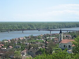
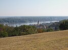
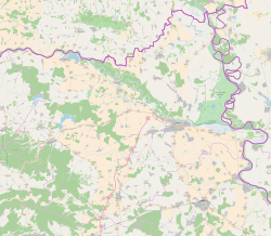
Batina (Hungarian: Kiskőszeg) is a port village on the right bank of the Danube in Baranja, Croatia. Its elevation is 105 m. Administratively, it is located in the Draž municipality within the Osijek-Baranja County.
Geography[]
Batina is located on the D212 state road connecting the village to the city of Osijek. In 1974 the road bridge over the Danube was built. It is a state border crossing.
History[]
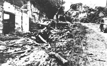
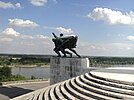
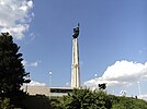
The village is known as the site of World War II Battle of Batina which took place from 11 to 29 November 1944. It was a battle between the units of the Red Army and the People's Liberation Army against the Wehrmacht and their allies. Today, a memorial site commemorates the battle which was one of the bloodiest World War II battles on Yugoslav soil.[2]
See also[]
- Osijek-Baranja county
- Baranja
References[]
- ^ "Population by Age and Sex, by Settlements, 2011 Census: Batina". Census of Population, Households and Dwellings 2011. Zagreb: Croatian Bureau of Statistics. December 2012.
- ^ Batinska bitka: Iz stroja izbačeno čak 23 000 vojnika (in Croatian)
External links[]
| Wikimedia Commons has media related to Batina, Osijek-Baranja County. |
| hide Authority control | |
|---|---|
| General | |
| National libraries | |
This Osijek-Baranja County geography article is a stub. You can help Wikipedia by . |
- Populated places in Osijek-Baranja County
- Baranya (region)
- Croatia–Serbia border
- Osijek-Baranja County geography stubs