Battle of Cañada Strongest
This article includes a list of references, related reading or external links, but its sources remain unclear because it lacks inline citations. (August 2014) |
| Battle of Cañada Strongest | |||||||
|---|---|---|---|---|---|---|---|
| Part of the Chaco War | |||||||
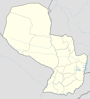
 Map of the battle | |||||||
| |||||||
| Belligerents | |||||||
|
|
| ||||||
| Commanders and leaders | |||||||
|
|
| ||||||
| Strength | |||||||
| 4 Divisions | 2 Divisions | ||||||
| Casualties and losses | |||||||
| Minimal |
400 dead 1500 prisoners | ||||||
 | |||||||
The Battle of Cañada Strongest was a battle fought from May 10–25, 1934, between the Bolivian and Paraguayan armies during the Chaco War. The engagement is considered the greatest victory of the Bolivian army during the war, and actually took place some 60 km southwest of Cañada Strongest, near a dried riverbed called Cañada Esperanza. The battle was a Paraguayan attempt to outflank and eventually conquer Fort Ballivian, a large stronghold that was the keystone of Bolivian defenses along the border with Argentina. Paraguayans begun to open a new trail in the dry subtropical forests of the Chaco but were discovered by Bolivian aerial reconnaissance. The Paraguayans troops, unaware of having been discovered, were encircled by Bolivian forces who had sneaked up on the path and were waiting for a substantial number of Paraguayan troops to enter the pathway before they ambushed them. A 250-man Paraguayan detachment sent in to monitor the Bolivian movements was also surrounded and eventually captured on May 25 along Lóbrego Path, a route between the first Paraguayan lines and Cañada Esperanza. The Bolivian army took 1,500 prisoners and a good amount of weaponry, trucks and supplies, while almost 400 Paraguayan soldiers were killed. A whole Paraguayan division, however, managed to slip away, along with some scattered units.
Sources[]
- Farcau, Bruce W. (1996): The Chaco War: Bolivia and Paraguay, 1932-1935, Greenwood Publishing Group, pp. 177–182. ISBN 0-275-95218-5
- Robert L. Schein. (2003): Latin America's Wars: The age of the professional soldier, 1900-2001, p. 98.
- Battles of the Chaco War
- Conflicts in 1934
- 1934 in Paraguay
- 1934 in Bolivia
- May 1934 events

