Bay of Mecklenburg
This article does not cite any sources. (December 2009) |
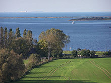

The Bay of Mecklenburg (German: Mecklenburger Bucht or Mecklenburgische Bucht; Danish: Mecklenburg Bugt), also known as the Mecklenburg Bay or Mecklenburg Bight, is a long narrow basin making up the southwestern finger-like arm of the Baltic Sea, between the shores of Germany to the south and the Danish islands of Lolland, Falster, and Møn to the north, the shores of Jutland to the west, and joining the largest part of the Baltic to the east.
The Bay of Mecklenburg, which includes the Bay of Wismar and the Bay of Lübeck, connects to the Bay of Kiel in the northwest. Notable ports in the bay are Lübeck, Rostock and Wismar.
See also[]
External links[]
![]() Media related to Bay of Mecklenburg at Wikimedia Commons
Media related to Bay of Mecklenburg at Wikimedia Commons
| Authority control |
|---|
Coordinates: 54°20′N 11°40′E / 54.333°N 11.667°E

This Schleswig-Holstein location article is a stub. You can help Wikipedia by . |
This Mecklenburg-Vorpommern location article is a stub. You can help Wikipedia by . |
This Danish location article is a stub. You can help Wikipedia by . |
- Bays of the Baltic Sea
- Bays of Mecklenburg-Vorpommern
- Bays of Denmark
- Bays of Schleswig-Holstein
- Schleswig-Holstein geography stubs
- Mecklenburg-Vorpommern geography stubs
- Denmark geography stubs