Bayan Har Mountains
| Bayan Har Mountains | |
|---|---|
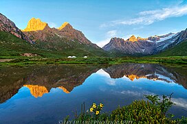 Yaonü lake | |
| Highest point | |
| Elevation | 5,266 m (17,277 ft) |
| Geography | |
| Location | Qinghai, China |
| Bayan Har Mountains | |||||||||||
|---|---|---|---|---|---|---|---|---|---|---|---|
| Chinese name | |||||||||||
| Traditional Chinese | 巴顏喀拉山脈 | ||||||||||
| Simplified Chinese | 巴颜喀拉山脉[a] | ||||||||||
| |||||||||||
| Tibetan name | |||||||||||
| Tibetan | བ་ཡན་ཁ་ལ་རག་མོ | ||||||||||
| Mongolian name | |||||||||||
| Mongolian Cyrillic | Баянхар уул | ||||||||||
| Mongolian script | ᠪᠠᠶᠠᠨᠬᠠᠷᠠ ᠠᠭᠤᠯᠠ | ||||||||||
The Bayan Har Mountains, formerly known as the Bayen-káras[2] or Bayan-Kara-Ula, are a mountain range in Qinghai Province, northwest China. The name is Mongolian for "Rich and Black".[3] It can be viewed as one of the branches of the Kunlun Mountains. It separates the drainage areas of both the Yellow and the Yangtze rivers. The source of the Yellow River is in the basin of , which is located in the northern part of the range.[4]
Notes[]
References[]
- ^ p. 628.
- ^ "China" in the Encyclopædia Britannica, 9th ed. 1878.
- ^ Sułek, Emilia Róża (2014), "Invisible Mongols: Observations from Fieldwork in Tibet" (PDF), A Window onto the Other: Contributions on the Study of the Mongolian, Turkic, and Manchu-Tungusic Peoples, Languages, and Cultures, Warsaw: University of Warsaw, p. 248.
- ^ "The source of the Yellow River" Archived November 20, 2008, at the Wayback Machine. Yellow River Conservancy Commission.
External links[]
Mountain ranges of China | |
|---|---|
| Northwest China | |
| Qinghai-Tibet and Southwest China | |
| Northeast China | |
| North and East China | |
| Central China | |
| South China | |
Coordinates: 34°42′N 98°13′E / 34.700°N 98.217°E

This Qinghai location article is a stub. You can help Wikipedia by . |
This Sichuan location article is a stub. You can help Wikipedia by . |
Categories:
- Mountain ranges of China
- Landforms of Qinghai
- Mountain ranges of Sichuan
- Northwestern China geography stubs
- Sichuan geography stubs