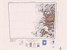
Beacon Heights

The Beacon Heights (77°50′S 160°50′E / 77.833°S 160.833°ECoordinates: 77°50′S 160°50′E / 77.833°S 160.833°E) are a small cluster of peaks between Beacon Valley and Arena Valley in Quartermain Mountains, Victoria Land, rising to 2,345 metres (7,700 ft) in West Beacon, and also including East Beacon and South Beacon. They were named by Hartley Ferrar, geologist with the British National Antarctic Expedition (1901–04). According to the USGS GNIS gazetteer, the heights were named after the Beacon Supergroup which caps them,[1] though another source indicates that the type of rock was named after these hills.[2]
References[]
- ^ U.S. Geological Survey Geographic Names Information System: Beacon Heights
- ^ Stewart, Duncan Jr. "The Petrography of the Beacon Sandstone of the South Victoria Land" (PDF). Mineralogical Society of America. Retrieved 2011-05-24.
 This article incorporates public domain material from the United States Geological Survey document: "Beacon Heights". (content from the Geographic Names Information System)
Categories:
- Mountains of Victoria Land
- Scott Coast
- Scott Coast geography stubs
 WikiMiniAtlas