Beanibazar Upazila
Beanibazar Upazila
বিয়ানীবাজার | |
|---|---|
 | |
| Coordinates: 24°49′30″N 92°09′45″E / 24.8250°N 92.1625°E | |
| Country | Bangladesh |
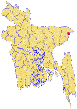
| Division | Sylhet Division |
| District | Sylhet District |
| Thana | 1938 |
| Upazila | 1983 |
| Government | |
| • MP (Sylhet-6) | Nurul Islam Nahid (Awami League) |
| • Pouro (City) Mayor | Md Abdus Shukur |
| • Upazila Chairman | Abul Qasim Pallav |
| Area | |
| • Total | 253.22 km2 (97.77 sq mi) |
| Population (2011) | |
| • Total | 253,616 |
| • Density | 1,000/km2 (2,600/sq mi) |
| Demonym(s) | Beanibazari |
| Time zone | UTC+6 (BST) |
| Postal code | 3170-75 |
| Website | www |

Beanibazar (Bengali: বিয়ানীবাজার, romanized: Biyanībazar, lit. 'Morning Market') is an upazila (sub-district) of Sylhet District in northeastern Bangladesh, part of the Sylhet Division.[1] The area is the successor of the territory of Panchakhanda, formerly ruled by the aristocratic Pal family.[2]
History[]
Like the rest of North Bengal and Mymensingh, Beanibazar was also a part of the Kamarupa Kingdom in ancient times. In the 7th century, King Bhaskaravarman granted land to over 200 Brahmins and the grant, known as the Nidhanpur copperplate inscription, was recorded in Sanskrit.[3][4]
After the Conquest of Gour in 1303, Khwaja Adina Sufi - a disciple of Shah Jalal - migrated to what is now Adinabad in Charkhai (in Beanibazar) where they preached Islam to the local people. The name Beanibazar is derived from the existing Bihani Bazaar ("Morning Market") which was founded by the local landowner Krishna Kishore Pal Chowdhury.[5]
On 29 December 1912, a cultivator in Nidhanpur village discovered what he thought was a clue to the location of a hidden treasure, during the process of building his buffalo shed. He took the plates to a local landholder who brought them to the attention of authorities in Silchar, thus rediscovering the Nidhanpur copperplate inscriptions.[6]
On 18 May 1940, one of the five thanas of the Karimganj Mahakuma, Jolodhup, was planned to also be split into two – Beanibazar and Barlekha. Beanibazar was given to the Sylhet Mahakuma while Barlekha went to South Sylhet Mahakuma.[7] The upazila was the headquarters of the Nankar Rebellion. Beanibazar became an upazila in 1983.[1] In 2009, the Beanibazar Sporting Club was founded.
Geography[]
Beanibazar is located at 24°49′30″N 92°09′45″E / 24.8250°N 92.1625°E. It has a total area of 253.22 km2.[8]
Sheola Sutarkandi International Border Crossing[]
Sheola-Sutarkandi International Border Crossing on Bangladesh–India border on Karimganj-Beanibazar route is in Karimganj district of the Indian state of Assam. Famous for having an International trade centre, Sutarkandi is an international border of India and Bangladesh. Through this space, export of fruits, silicon and coal is done. The place is situated in the district of Karimganj, Assam. It is located 14 km away from Karimganj and contains principal custom check post for the trade flow. Two national highway runs through Sutarkandi that is National Highway 151 (old) and National Highway 7 (new) which is 45 km from the border of Sylhet town of Bangladesh.[9]
Demographics[]
| Year | Pop. (000) | ±% |
|---|---|---|
| 1981 | 161 | — |
| 1991 | 182 | +13.0% |
| 2001 | 211 | +15.9% |
| 2011 | 254 | +20.4% |
| Source: Bangladesh Bureau of Statistics[10] | ||
According to the 2011 Bangladesh census, Beanibazar Upazila had 42,119 households and a population of 253,616, 16.6% of whom lived in urban areas. 11.3% of the population was under the age of 5. The literacy rate (age 7 and over) was 59.7%, compared to the national average of 51.8%.[11][12]
Administration[]
Beanibazar Upazila is divided into Beanibazar Municipality and ten union parishads: Alinagar, Charkhai, Dubag, Kurarbazar, Lauta, Mathiura (sola kak), Mullapur, Muria, Sheola, and Tilpara. The union parishads are subdivided into 132 mauzas and 174 villages.[10]
Beanibazar Municipality is subdivided into 9 wards and 37 mahallas.[10]
- Pourashava: Dashgram, Khasharipara, Sreedhora, Nobang, Kashba, Pondit Para, Supatala, Noyagram, Fothepur, Khasha
- Alinagar: Raykhail, Rajapur, Chandgram, Nij Muhammadpur, Kadimolik, Konkalosh, Khasha, Kholagram, Uzandaki, Hatim Khani, Korgram, Dudair Paton, Chondor pur, Uttarbhag Nowagram, Beani bazar, Tikorpara, Uttar Bhag, Routh Bhag, Nosir Khani
- Charkhai: Duttagram, Agiram, Bilua, Deulgram, Bagbari, Dahal, Gulaghat, Sachan, Shafachak, Torongo, Jalalnagar, Adinabad, Mondergram, Koskot Khan
- Dubag: Kharavora, Gozukata, Goilapur, Charia, Mewa, Ejra, Panjipuri, Moyakhali, Dubag, Sylhetipara, Bangalhuda, Noya dubag, Chokorbondo, Shutarkandi, Kunagam, Borogram
- 5 No. Kurar Bazar: Aaqakhazana, Govindasree, Angura Muhammadpur, Deulgram, Angura Falokuna, North Aaqakhazana (Lamligram), Lawjary, Goror Band, Khashir Band, Khashir Naam Nagar, Khashir Band Haati Tila, Arij Khan Tila, Sharak Bhangni, Angarjur, Malarghaon
- Lauta: Phariabohor, Kalibahar, Jaldhup, Baurbag, Kalaiura, Baraigram, Gultikar, Bahadurpur, Tikarpara, Nandirpal, Gangpar, Gojarai, Astoshangon, Hijlor Tuk, Kanli
- Mathiura
- Mullapur: Abdullapur, Pata, Huknia Moholla, Nidhanpur, Lama Nidhanpur, Usphara, Barigram, Chandagram, Matikata, Kashatul, Lushaitola, Sopatola
- Muria: Chhotadesh, Fengram, Bagon, Kunagram, Abhongi, Ashtogori, Baradesh, Barudha, Maijkapon, Chandagram, Noagaon, Ghungadia, Moirangon, Sharoper, Tajpur, Takaikuna, Noagram
- Sheola: Balinga, Kakordia, Teradol, shaleswar, ghorua, charaboi, daudpur
- Tilpara: Dasura, Sodorpur, Matizura, Holimpur, Gangukul, Kamarkhandi, Tuka voraut, Shaneshor, Bibiray, Rojob, Debarai, Kangkul, Pirerchok, Dokkin Dsura
Upazila Chairmen[]
| Name | Term | Notes |
|---|---|---|
| Muzzammil Ali | 5/1985 - 5/1990 | |
| Muzammil Ali | 16/7/1990 - 11/1991 | Second term |
| Abdul Khaliq Mayon | 22/2/2009 - 29/1/2011 | |
| Begum Ruma Chakrabarti | 9/2/2011 - 14/5/2014 | Temporary |
| Ataur Rahman Khan | 14/5/2014 - | |
| Abul Qasim Pallav | Present |
News papers[]
Notable people[]
- Athar Ali Bengali, 20th-century politician and Islamic scholar
- Tawfiq-e-Elahi Chowdhury, energy advisor to the Prime Minister of Bangladesh
- Hansen Clarke, American former congressman
- Govinda Chandra Dev, philosopher and lecturer
- Lenin Gani, sports journalist
- Helal Khan, film actor
- Hasina Momtaz, former press officer for the Mayor of London
- Nurul Islam Nahid, former Minister of Education in Bangladesh
- Pal family, aristocratic landowning family
See also[]
- Nidhanpur copperplate inscription
- Upazilas of Bangladesh
References[]
- ^ a b Azizur Rahman (2012). "Beanibazar Upazila". In Islam, Sirajul; Miah, Sajahan; Khanam, Mahfuza; Ahmed, Sabbir (eds.). Banglapedia: the National Encyclopedia of Bangladesh (Online ed.). Dhaka, Bangladesh: Banglapedia Trust, Asiatic Society of Bangladesh. ISBN 984-32-0576-6. OCLC 52727562. Retrieved 26 December 2021.
- ^ Barua, Bharati (1991). Glimpses into Religion in Kamarupa during the Reign of Kumara Bhaskaravarman : A study on Contemporary Evidences. Proceedings of North East India History Association. North East India History Association. p. 129.
- ^ Sircar, Dineshchandra (1971). Studies in the geography of ancient and medieval India. Motilal Banarsidass. p. 161.
- ^ Chatterjee, Suhas (1998). Indian Civilization and Culture. M.D. Publications Pvt. Ltd. p. 432.
- ^ উপজেলার পটভূমি. Beanibazar Upazila (in Bengali). Bangladesh.gov.bd. 2020-01-13. Retrieved 2020-01-14.
- ^ Vidyavinoda, Padmanatha Bhattacharya. Hultzsch, E. (ed.). Epigraphia Indica Vol. - XII (1913 - 1914). pp. 65–79.
- ^ উপজেলা পটভূমি. Government of Bangladesh (in Bengali). Retrieved 24 September 2018.
- ^ http://www.beanibazarkontho.com/
- ^ https://www.tourmyindia.com/states/assam/sutarkandi-indo-bangladesh-border.html
- ^ a b c "District Statistics 2011: Sylhet" (PDF). Bangladesh Bureau of Statistics. Archived from the original (PDF) on 13 November 2014. Retrieved 14 July 2014.
- ^ "Community Report: Sylhet" (PDF). Population & Housing Census 2011. Bangladesh Bureau of Statistics. Retrieved 15 August 2018.
- ^ "Population and Housing Census 2011: Bangladesh at a Glance" (PDF). Bangladesh Bureau of Statistics. Archived from the original (PDF) on 28 July 2014. Retrieved 21 July 2014.
- ^ প্রচ্ছদ – বিয়ানীবাজার কন্ঠ. www.beanibazarkontho.com. Retrieved 1 January 2018.
Capital: Sylhet | ||
| Upazilas | ||
| Constituencies | ||
| Attractions and sites |
| |
| Rivers | ||
| Inhabited areas | ||
| Schools and colleges |
| |
| Madrasas | ||
| Universities | ||
| Transport | ||
| Organisations | ||
| History | ||
| Military | ||
| Medicine | ||
| Economy | ||
| Sports | ||
- Beanibazar Upazila