Beerzel
Beerzel | |
|---|---|
Village | |
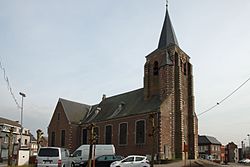 Saint Remigus Church | |
 Beerzel Location in Belgium | |
| Coordinates: 51°04′N 4°40′E / 51.067°N 4.667°ECoordinates: 51°04′N 4°40′E / 51.067°N 4.667°E | |
| Country | |
| Region | Flemish Region |
| Province | Antwerp |
| Municipality | Putte |
| Area | |
| • Total | 7.83 km2 (3.02 sq mi) |
| Population (1995)[1] | |
| • Total | 4,971 |
| • Density | 630/km2 (1,600/sq mi) |
| Time zone | CET |

Beerzel (Dutch: [ˈbeːrzəl] (![]() listen)) is a Belgian village in Antwerp Province and a deelgemeente of the municipality Putte. Beerzel was a municipality until 1977, at which time it had an area of 7.83 square kilometres (3.02 sq mi) with 4,971 inhabitants in 1995.[1] At 51.6 metres (169 ft), Antwerp's highest point—the Beerzelberg—is located in Beerzel.[2]
listen)) is a Belgian village in Antwerp Province and a deelgemeente of the municipality Putte. Beerzel was a municipality until 1977, at which time it had an area of 7.83 square kilometres (3.02 sq mi) with 4,971 inhabitants in 1995.[1] At 51.6 metres (169 ft), Antwerp's highest point—the Beerzelberg—is located in Beerzel.[2]
History[]
Pottery from the early Bronze age had been discovered in Beerzel. The village was first mentioned as Barsale in 1151. Until the World War I, a large beech was located at the top of the Beerzelberg. Beerzel was an independent municipality until 1977 when it merged into Putte.[3]
Notable people[]
- Jos Huysmans (1941–2012), road bicycle racer.[4]
References[]
- ^ Jump up to: a b c "Beerzel". Agentschap Onroerend Erfgoed (in Dutch). Retrieved 28 October 2020.
- ^ "Beerzelberg". Natuurpunt De Putter (in Dutch). Retrieved 28 October 2020.
- ^ "Putte". Agentschap Onroerend Erfgoed (in Dutch). Retrieved 28 October 2020.
- ^ "Hulde aan meesterknecht Jos Huysmans". De Gazet van Antwerpen (in Dutch). Retrieved 28 October 2020.
External links[]
 Media related to Beerzel at Wikimedia Commons
| Authority control |
|
|---|
This Antwerp Province location article is a stub. You can help Wikipedia by . |
Categories:
- Populated places in Antwerp (province)
- Putte
- Antwerp geography stubs