Begur, Spain
Begur | |
|---|---|
 Town of Begur (with view of ) | |
 Flag  Coat of arms | |
 | |
| Coordinates: 41°57′N 3°13′E / 41.950°N 3.217°ECoordinates: 41°57′N 3°13′E / 41.950°N 3.217°E | |
| Country | Spain |
| Autonomous community | |
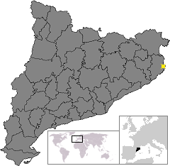
| Province | Girona |
| Comarca | Baix Empordà |
| Government | |
| • mayor | Joan Manel Loureiro Vall (2015)[1] |
| Area | |
| • Total | 20.7 km2 (8.0 sq mi) |
| Elevation | 200 m (700 ft) |
| Population (2018)[3] | |
| • Total | 3,934 |
| • Density | 190/km2 (490/sq mi) |
| Postal code | 17255 |
| Website | begur |


Begur is a municipality in the comarca of the Baix Empordà in Catalonia, Spain, on the coastline of the Costa Brava.
Begur has 3,986 inhabitants (according to the census of 2005). It is an important tourist attraction in the Baix Empordà. During the summer, the population can exceed 40,000 people.
Despite its tourist character, the village has important historical remnants that go back in early history. The castle of Begur is a good example of medieval remains. The castle was constructed in the 16th and 17th centuries.
The town of Begur also includes Esclanyà (with a Romanesque old part), Aiguafreda, Sa Riera, Sa Tuna, Aiguablava and Fornells. Some of the most prestigious beaches of the Costa Brava can be found here: Sa Riera, Aiguafreda, sa Tuna, Platja Fonda (although it has been almost completely destroyed by storms), Fornells and Aiguablava. The latter is also home to a Parador Hotel.
The municipality includes the following localities:
- Aigua Blava
- Aiguafreda
- Begur
- Esclanyà
- Fornells
- el Racó
- Sa Riera
- sa Tuna
The annual festival to celebrate St. Tania takes places each November.
References[]
- ^ "Ajuntament de Begur". Generalitat of Catalonia. Retrieved 2015-11-13.
- ^ "El municipi en xifres: Begur". Statistical Institute of Catalonia. Retrieved 2015-11-23.
- ^ Municipal Register of Spain 2018. National Statistics Institute.
External links[]
- Official website
- Official website for tourists
- The international website of Begur
- Government data pages (in Catalan)
| show Places adjacent to Begur, Spain |
|---|
| show Municipalities of Baix Empordà |
|---|
| show Municipalities of the province of Girona |
|---|
| show Authority control |
|---|
This Province of Girona location article is a stub. You can help Wikipedia by . |
- Municipalities in Baix Empordà
- Cittaslow
- Populated places in Baix Empordà
- Populated coastal places in Spain
- Province of Girona geography stubs