Belén District, Sucre
Belén District | |
|---|---|
 | |
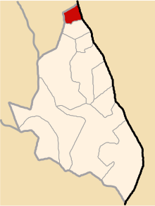 Location of Belen in the Sucre province | |
| Country | |
| Department | |
| Province | Sucre |
| Founded | November 23, 1964 |
| Capital | |
| Subdivisions | 4 populated places |
| Government | |
| • Mayor | Julián Elías Cárdenas Pérez |
| Area | |
| • Total | 41.46 km2 (16.01 sq mi) |
| Elevation | 3,195 m (10,482 ft) |
| Population (2005 census) | |
| • Total | 611 |
| • Density | 15/km2 (38/sq mi) |
| Time zone | UTC-5 (PET) |
| UBIGEO | 050902 |
Belén is one of 11 districts of the Sucre Province in the Ayacucho region in Peru.
History[]
Belén District was created by Law No.15231 in Nov 23, 1964, during first term of President Fernando Belaúnde
Administrative division[]
The populated places in the district are:[1]
- Belen
- Socos
- Cochayocc
- Cuije
Population[]
The population of Belén is 611 people, 292 men and 319 women.[1]
Ethnic groups[]
The people in the district are mainly indigenous citizens of Quechua descent. Quechua is the language which the majority of the population (79.32%) learnt to speak in childhood, 20.52% of the residents started speaking using the Spanish language (2007 Peru Census).[2]
Authorities[]
Mayors[]
- 2011-2014: Julián Elías Cárdenas Pérez.
- 2007-2010: José Luis Romero Sheron.
Festivities[]
This section is empty. You can help by . (December 2012) |
See also[]
- Subdivisions of Peru
References[]
- ^ a b INEI Archived 2007-06-01 at the Wayback Machine
- ^ inei.gob.pe Archived January 27, 2013, at the Wayback Machine INEI, Peru, Censos Nacionales 2007, Frequencias: Preguntas de Población: Idioma o lengua con el que aprendió hablar (in Spanish)
External links[]
| |
|---|---|
| Cangallo | |
| Huamanga | |
| Huanca Sancos | |
| Huanta | |
| La Mar | |
| Lucanas | |
| Parinacochas | |
| Paucar del Sara Sara | |
| Sucre | |
| Víctor Fajardo | |
| Vilcas Huamán | |
Coordinates: 13°48′34″S 73°45′24″W / 13.80944°S 73.75667°W

This Ayacucho Region geography article is a stub. You can help Wikipedia by . |
Categories:
- Districts of the Ayacucho Region
- Districts of the Sucre Province
- Ayacucho Region geography stubs