Bel-Air Park
Bel-Air Park | |
|---|---|
Neighbourhood | |
 Bel-Air Park | |
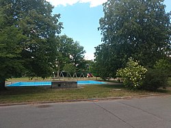
 Bel-Air Park Location in Ottawa | |
| Coordinates: 45°21′30″N 75°45′50″W / 45.35833°N 75.76389°W | |
| Country | Canada |
| Province | Ontario |
| City | Ottawa |
| Government | |
| • MP | Anita Vandenbeld |
| • MPP | Jeremy Roberts |
| • Councillor | Rick Chiarelli |
| • Bel-Air Community Association Co-Presidents | Kathryn Loyen, Jean Mullan[1] |
| Elevation | 80 m (260 ft) |
| Time zone | UTC−5 (Eastern (EST)) |
| • Summer (DST) | UTC−4 (EDT) |
| Forward sortation area | K2C |

Bel-Air Park (also spelled Bel Air Park[2]) is a neighbourhood in College Ward in the west end of Ottawa, Ontario, Canada. It is bounded on the east by the Experimental Farm Pathway, on the south by Baseline Road, on the west by Woodroffe Avenue and on the north by the Queensway.
All of the homes were built between 1956 and 1958, and were built by the Campeau Corporation.[3] The neighbourhood is home to Bel-Air Park on Berwick Avenue. Iris Street is the main road in the neighbourhood. Bel-Air Drive starts at Checkers Road and ends in Braemar Park on Garfield close to Maitland Drive. For schools there is Agincourt Public School, J. H. Putman Public School, St. Daniel's Catholic School, Torah Academy Jewish School (Formerly St. Andrew's Adult High School) located on Lazard Street, Charlotte Lemieux French School and Woodroffe High School.
The population of the neighbourhood is roughly 1700.
Along with Bel-Air Heights and Braemar Park, the area is part of the Bel-Air Community Association.[4]
Places adjacent to Bel-Air Park | |
|---|---|
References[]
- ^ "Bel Air Community Association - About Us".
- ^ "Place names - Bel Air Park".
- ^ "Campeau Construction to Build in Ottawa's West End". Ottawa Citizen. February 25, 1956. Retrieved June 22, 2020.
- ^ https://www.facebook.com/belaircommunityassociation/?ref=page_internal
This article relating to Ottawa and to Canada's National Capital Region is a stub. You can help Wikipedia by . |
- Neighbourhoods in Ottawa
- Ottawa stubs