Belfeld
Coordinates: 51°19′N 6°7′E / 51.317°N 6.117°E

Belfeld | |
|---|---|
 Flag  Coat of arms | |
 | |
| Country | Netherlands |
| Province | Limburg |
| Municipality | Venlo |
| Population (2006) | ca. 5.450 |
| Major roads | |

Former town hall

Sculpture at the roudabout
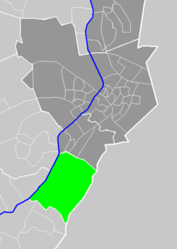
Belfeld (Limburgish: Belvend) is a village in the Dutch province of Limburg. It is a part of the municipality of Venlo, and lies about 8 km southwest of the city center of Venlo, between the river Meuse and the border with Germany.
In 2001, Belfeld had 4856 inhabitants. The built-up area of the town was 1.59 km², and contained 1937 residences.[1]
In 2001 Belfeld was merged into the municipality of Venlo.
References[]
- ^ Statistics Netherlands (CBS), Bevolkingskernen in Nederland 2001 "Archived copy". Archived from the original on 2006-03-19. Retrieved 2007-01-24.CS1 maint: archived copy as title (link). Statistics are for the continuous built-up area.
External links[]
- J. Kuyper, Gemeente Atlas van Nederland, 1865-1870, "Belfeld". Map of the former municipality, around 1868.
This Dutch Limburg location article is a stub. You can help Wikipedia by . |
Categories:
- Boroughs of Venlo
- Former municipalities of Limburg (Netherlands)
- Populated places in Limburg (Netherlands)
- Limburg (Netherlands) geography stubs