Belon'i Tsiribihina
Belon'i Tsiribihina
Belo sur Tsiribihina | |
|---|---|
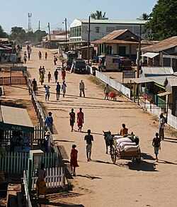 | |
 Belon'i Tsiribihina Location in Madagascar | |
| Coordinates: 19°42′S 44°33′E / 19.700°S 44.550°E | |
| Country | |
| Region | Menabe |
| District | Belo sur Tsiribihina |
| Government | |
| • Mayor | Ratsimbalson Faharo |
| Area | |
| • Total | 2,561 sq mi (6,633 km2) |
| • Land | 2,561 sq mi (6,633 km2) |
| Elevation | 56 ft (17 m) |
| Population (2001)[1] | |
| • Total | 72,000 |
| Time zone | UTC3 (EAT) |

Belon'i Tsiribihina (also known as Belo sur Tsiribihina or Belo - Tsiribihina) is a town and commune (Malagasy: kaominina) in Madagascar. It belongs to the district of Belo sur Tsiribihina, which is a part of Menabe Region. It is situated at the mouth of the Tsiribihina River. The population of the commune was estimated to be approximately 72,000 in 2001 commune census.[1]
Belon'i Tsiribihina is served by a local airport. In addition to primary schooling the town offers secondary education at both junior and senior levels. The town provides access to hospital services to its citizens.[1]
The majority 60% of the population of the commune are farmers, while an additional 20% receives their livelihood from raising livestock. The most important crop is rice, while other important products are beans and chickpea. Services provide employment for 10% of the population. Additionally fishing employs 10% of the population.[1]
See also[]
References and notes[]
- ^ Jump up to: a b c d "ILO census data". Cornell University. 2002. Retrieved 2008-03-10.
- ^ Estimated based on DEM data from Shuttle Radar Topography Mission
| hide | ||
|---|---|---|
Capital: Morondava | ||
| Belo sur Tsiribihina (14) |  | |
| Mahabo (11) | ||
| Manja (6) | ||
| Miandrivazo (15) | ||
| Morondava (5) | ||
5 districts; 51 communes | ||
| Authority control |
|
|---|
- Populated places in Menabe