Benschop, Utrecht
Benschop | |
|---|---|
Town | |
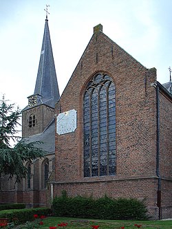 De Nicolaaskerk van Benschop | |
 | |
 The town centre (darkgreen) and the statistical district (lightgreen) of Benschop in the municipality of Lopik. | |
| Coordinates: 52°0′26″N 4°58′46″E / 52.00722°N 4.97944°ECoordinates: 52°0′26″N 4°58′46″E / 52.00722°N 4.97944°E | |
| Country | Netherlands |
| Province | Utrecht (province) |
| Municipality | Lopik |
| Area | |
| • Total | 15 km2 (6 sq mi) |
| Population (2018[1]) | |
| • Total | 3,650 |
| • Density | 240/km2 (630/sq mi) |
| Time zone | UTC+1 (CET) |
| • Summer (DST) | UTC+2 (CEST) |
| Postal code | 3405 |
| Dialing code | 0348 |

Benschop is a town in the Dutch province of Utrecht. It is a part of the municipality of Lopik, and lies about 4 km west of IJsselstein. Benschop is an extremely long village: apart from a relatively compact town centre, it consists of a long ribbon (over 8 km long) of houses (mainly farms) on both sides of the Benschopsche Wetering.
In 2001, the town centre of Benschop had 1,968 inhabitants. The built-up area of the town was 0.3 km², and contained 683 residences.[2] The statistical district of Benschop, which covers the entire former municipality, has a population of about 3,530, and an area of about 23 km².[3]
Until 1989, Benschop was a separate municipality.
References[]
- ^ CBS Statline
- ^ Statistics Netherlands (CBS), Bevolkingskernen in Nederland 2001 "Archived copy". Archived from the original on 2006-03-19. Retrieved 2007-01-24.CS1 maint: archived copy as title (link). Statistics are for the continuous built-up area.
- ^ Statistics Netherlands (CBS), Gemeente Op Maat 2004: Lopik [1][permanent dead link].
External links[]
- J. Kuyper, Gemeente Atlas van Nederland, 1865-1870, "Benschop". Map of Benschop in 1868.
This Utrecht location article is a stub. You can help Wikipedia by . |
Categories:
- Former municipalities of Utrecht (province)
- Populated places in Utrecht (province)
- Lopik
- Utrecht (province) geography stubs