Berlin Storkower Straße station
This article needs additional citations for verification. (August 2010) |
Storkower Straße | ||||||||||||||||||||||||||
|---|---|---|---|---|---|---|---|---|---|---|---|---|---|---|---|---|---|---|---|---|---|---|---|---|---|---|
| Hp | ||||||||||||||||||||||||||
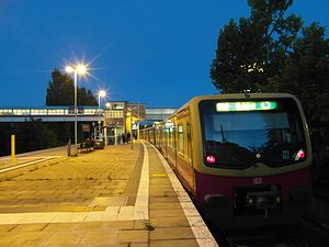 Platform view | ||||||||||||||||||||||||||
| Location | Storkower Straße, Fennpfuhl Hermann-Blankenstein-Straße, Prenzlauer Berg Pankow, Berlin, Berlin Germany | |||||||||||||||||||||||||
| Coordinates | 52°31′26″N 13°27′52″E / 52.52389°N 13.46444°ECoordinates: 52°31′26″N 13°27′52″E / 52.52389°N 13.46444°E | |||||||||||||||||||||||||
| Owned by | Deutsche Bahn | |||||||||||||||||||||||||
| Operated by | ||||||||||||||||||||||||||
| Line(s) | Ringbahn | |||||||||||||||||||||||||
| Platforms | 1 island platform | |||||||||||||||||||||||||
| Tracks | 2 | |||||||||||||||||||||||||
| Train operators | S-Bahn Berlin | |||||||||||||||||||||||||
| Connections | ||||||||||||||||||||||||||
| Other information | ||||||||||||||||||||||||||
| Station code | 6042 | |||||||||||||||||||||||||
| DS100 code | BSTO[1] | |||||||||||||||||||||||||
| IBNR | 8089041 | |||||||||||||||||||||||||
| Category | 4[2] | |||||||||||||||||||||||||
| Fare zone | VBB: Berlin A/5555[3] | |||||||||||||||||||||||||
| Website | www.bahnhof.de | |||||||||||||||||||||||||
| History | ||||||||||||||||||||||||||
| Opened | 4 May 1881 | |||||||||||||||||||||||||
| Services | ||||||||||||||||||||||||||
| ||||||||||||||||||||||||||
 | ||||||||||||||||||||||||||
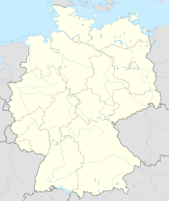
| Location | ||||||||||||||||||||||||||
 Storkower Straße Location in Berlin | ||||||||||||||||||||||||||


Storkower Straße is a railway station in the Prenzlauer Berg locality of Berlin, close to the locality's border with Fennpfuhl. Located at the Ringbahn it is served by the S-Bahn lines ![]() ,
, ![]() ,
, ![]() and
and ![]() .
.
History[]
The station was opened in 1881 under the name of Zentralviehhof, as the vast area south of the station then was the site of Berlin's central slaughterhouse that received animals by rail here. An over 400-metre (0.25 mi) long pedestrian bridge (called the Langer Jammer, i.e. "Long Misery") crossed the processing plant connecting the station with the Friedrichshain residential areas.

The station was renamed in the 1970s, while in 1991 the slaughterhouse finally closed. The notorious bridge except for about 150 m (490 ft) above the tracks was demolished in 2002. The remaining portion of the bridge, which stretches from Storkower Straße north of the station to Hermann-Blankenstein-Straße south of the station, was renovated and now serves as the only entrance and exit to the station.
References[]
- ^ Eisenbahnatlas Deutschland (German railway atlas) (2009/2010 ed.). Schweers + Wall. 2009. ISBN 978-3-89494-139-0.
- ^ "Stationspreisliste 2021" [Station price list 2021] (PDF) (in German). DB Station&Service. 16 November 2020. Retrieved 3 December 2020.
- ^ "Der VBB-Tarif: Aufteilung des Verbundgebietes in Tarifwaben und Tarifbereiche" (PDF). Verkehrsbetrieb Potsdam. Verkehrsverbund Berlin-Brandenburg. 1 January 2017. Archived from the original (PDF) on 27 October 2020. Retrieved 26 November 2019.
| Wikimedia Commons has media related to Bahnhof Berlin Storkower Straße. |
This article about a railway station in Berlin is a stub. You can help Wikipedia by . |
This Berlin S-Bahn-related article is a stub. You can help Wikipedia by . |
- Railway stations in Berlin
- Berlin S-Bahn stations
- Buildings and structures in Pankow
- Railway stations in Germany opened in 1881
- Berlin railway station stubs
- Berlin S-Bahn stubs