Bermejo, Bolivia
Bermejo | |
|---|---|
City | |
| Nickname(s): "Capital Petrolera de Bolivia" | |
 Bermejo Location in Bolivia | |
| Coordinates: 22°43′56″S 64°20′33″W / 22.73222°S 64.34250°WCoordinates: 22°43′56″S 64°20′33″W / 22.73222°S 64.34250°W | |
| Country | |
| Department | Tarija Department |
| Province | Ancieto Arce |
| Elevation | 609 m (1,998 ft) |
| Population (2012) | |
| • Total | 35,411 |
| Time zone | UTC-4 (BOT) |
Bermejo is a city in Bolivia, south of the Tariquía Flora and Fauna National Reserve. It is in a broad, open valley of the Cordillera Central range that extends southward into Argentina, and is on the Bermejo River, locally the border between Bolivia and Argentina.[1][2]
It is served by Bermejo Airport.

Colonial church in Bermejo
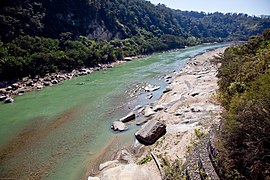
Bermejo River


References[]
- ^ "Google Maps". Google Maps. Retrieved 25 April 2016.
- ^ OpenStreetMap - Bermejo
External links[]
- Account of a trip to the city of Bermejo in 2016 (in Spanish)
Categories:
- Populated places in Tarija Department
- Argentina–Bolivia border crossings
- Bolivia geography stubs