Bhamo
Bhamo
ဗန်းမော်မြို့ (ဝဵင်းမၢၼ်ႈမူဝ်ႇ) Hsinkai[1] | |
|---|---|
 | |
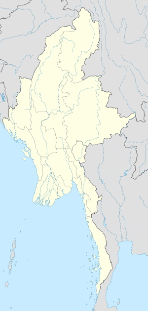 Bhamo Location in Burma | |
| Coordinates: 24°16′0″N 97°14′0″E / 24.26667°N 97.23333°E | |
| Country | |
| Division | |
| District | Bhamo District |
| Township | Bhamo Township |
| Population (2005) | |
| • Total | 47,920[2] |
| • Ethnicities | Shan Kachin Chinese |
| • Religions | Theravada Buddhism |
| Time zone | UTC+6.30 (MST) |
| Climate | Cwa |

Bhamo (Burmese: ဗန်းမော်မြို့ ban: mau mrui., also spelt Banmaw; Shan: မၢၼ်ႈမူဝ်ႇ; Tai Nuea: ᥛᥫᥒᥰ ᥛᥨᥝᥱ; Chinese: 新街, Hsinkai) is a city in Kachin State in northern Myanmar, 186 km (116 mi) south of the state capital, (Myitkyina). It is on the Ayeyarwady River. It lies within 65 km (40 mi) of the border with Yunnan Province, China.[3] The population consists of Chinese and Shan, with Kachin peoples in the hills around the town. It is the administrative center of Bhamo District and Bhamo Township.
Etymology[]
"Bhamo" derives from the Shan language term "Manmaw" (Shan: မၢၼ်ႈမေႃႇး, /maan˧ mɔ˧/; Tai Nuea: ᥛᥫᥒᥰ ᥛᥨᥝᥱ), which means "potter's village."[4]
History[]


From 1869 to 1879, it was the seat of British colonial Assistant political agent, subordinate to the Resident with the king of and in Ava. In the early 20th century, due to its location at the highest navigable point of the river, it formed a part of caravan routes bringing jade from India to China.[5]
Bhamo was once called Sampanago, the capital of the now-extinct Shan predecessor kingdom of Wanmaw. The ruins of the old city walls, dating from the fifth century, are found some 5 kilometres (3.1 mi) from the modern town.[citation needed]
Contemporary[]
A once weekly Myanma Airways flight is available, as are three times a week river ferries. It is the terminus of river ferries from Mandalay. There is no river ferry between Bhamo and state capital Myitkyina. The land route between Bhamo and Mu Se District (Muse, part of Northern Shan State), is in poor condition.
Bhamo is one of the official border trading towns between China and Myanmar.
Education[]
The town is home to Bhamo University. One can also study Engineering at Technological University(Bamaw), and computer and networking at Computer University(Bamaw).
Climate[]
Bhamo has a climate that lies in the transition between humid subtropical climate (Köppen climate classification Cwa) and tropical savanna climate (Köppen climate classification Aw). Temperatures are very warm throughout the year, although the winter months (December–February) are milder. There is a winter dry season (November–April) and a summer wet season (May–October).
| hideClimate data for Bhamo (1981–2010) | |||||||||||||
|---|---|---|---|---|---|---|---|---|---|---|---|---|---|
| Month | Jan | Feb | Mar | Apr | May | Jun | Jul | Aug | Sep | Oct | Nov | Dec | Year |
| Record high °C (°F) | 30.6 (87.1) |
35.8 (96.4) |
39.0 (102.2) |
39.5 (103.1) |
41.3 (106.3) |
41.5 (106.7) |
36.5 (97.7) |
37.0 (98.6) |
38.5 (101.3) |
36.9 (98.4) |
33.6 (92.5) |
31.5 (88.7) |
41.5 (106.7) |
| Average high °C (°F) | 25.6 (78.1) |
28.1 (82.6) |
31.7 (89.1) |
34.0 (93.2) |
33.9 (93.0) |
32.3 (90.1) |
31.4 (88.5) |
31.7 (89.1) |
31.9 (89.4) |
30.9 (87.6) |
28.1 (82.6) |
25.5 (77.9) |
30.4 (86.7) |
| Average low °C (°F) | 10.1 (50.2) |
12.5 (54.5) |
16.0 (60.8) |
20.2 (68.4) |
23.1 (73.6) |
24.7 (76.5) |
24.8 (76.6) |
24.5 (76.1) |
23.8 (74.8) |
21.7 (71.1) |
16.5 (61.7) |
11.9 (53.4) |
19.2 (66.6) |
| Record low °C (°F) | 7.0 (44.6) |
7.7 (45.9) |
9.5 (49.1) |
16.5 (61.7) |
19.0 (66.2) |
21.5 (70.7) |
22.0 (71.6) |
21.0 (69.8) |
21.2 (70.2) |
16.2 (61.2) |
10.0 (50.0) |
6.8 (44.2) |
6.8 (44.2) |
| Average rainfall mm (inches) | 5.4 (0.21) |
14.6 (0.57) |
15.0 (0.59) |
52.6 (2.07) |
177.1 (6.97) |
344.6 (13.57) |
406.0 (15.98) |
411.8 (16.21) |
217.1 (8.55) |
129.0 (5.08) |
38.7 (1.52) |
7.3 (0.29) |
1,819.2 (71.62) |
| Source: Norwegian Meteorological Institute[6] | |||||||||||||
See also[]

- Banmaw Airport
References[]
- ^ "An Introduction to the Toponymy of Burma" The Permanent Committee of Geographic Names (PCGN), United Kingdom, October 2007, page 12, accessed 18 April 2010
- ^ "Archived copy". Archived from the original on 20 June 2015. Retrieved 20 June 2015.CS1 maint: archived copy as title (link)
- ^ "Bhamo", Encyclopædia Britannica
- ^ Tun, Than (1988). "Observations on the Translation and Annotation of the Royal Orders Of Burma". Crossroads: An Interdisciplinary Journal of Southeast Asian Studies. 4 (1): 91–99. JSTOR 40860260.
- ^ The Modern world encyclopaedia : illustrated. Home Entertainment Library. 1935. OCLC 1091880941.
- ^ "Myanmar Climate Report" (PDF). Norwegian Meteorological Institute. pp. 23–36. Archived from the original (PDF) on 8 October 2018. Retrieved 28 October 2018.
Sources[]
Further reading[]
| Wikisource has the text of the 1911 Encyclopædia Britannica article "Bhamo". |
- 17th Century Burma and the Dutch East Indies Company 1634–1680, by Wil O. Dijk, NIAS Press
Coordinates: 24°16′N 97°14′E / 24.267°N 97.233°E
| Wikimedia Commons has media related to Bhamo. |
| hide | ||
|---|---|---|
Capital: Myitkyina | ||
| Bhamo District |   | |
| Mohnyin District | ||
| Myitkyina District | ||
| Putao District | ||
| Main cities and towns | ||
- Township capitals of Myanmar
- Populated places in Kachin State
- Irrawaddy River