Bigu Rural Municipality
Bigu
बिगु | |
|---|---|
Gaupalika | |
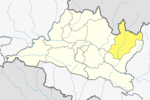
 Bigu Location in Nepal | |
| Coordinates: 27°50′N 86°04′E / 27.84°N 86.06°ECoordinates: 27°50′N 86°04′E / 27.84°N 86.06°E | |
| Country | |
| Province | Bagmati Province |
| District | Dolakha District |
| Population (1991) | |
| • Total | 1,736 |
| Time zone | UTC+5:45 (Nepal Time) |
| Website | https://bigumun.gov.np/ |

Bigu is a former village development committee that is now a ward-7 Bigu Rural Municipality in Dolakha District in Bagmati Province of north-eastern Nepal. At the time of the 1991 Nepal census it had a population of 1,736 people living in 361 individual households.
Bigu Jagat Purno Monastery and a Tashi Chyma Gachhal Gumba (Nunnery Monastery under Dukpa Kaguyu),
Deudhunga #Aabachukulung are point of attraction. Majority of people follow Tibetan Buddhism Nyingmapa sectors.
Majority are Sherpa's and Sherpa clan in Bigu are ( Ngaba, lama serwa, Surba or Salakh,Garja & Chawa).
Other are ethnicity are Thami, Magar, Newar , Chatri. Bujal.
There is Demolished Sherpa Palace or Castle (Kingdom) only one of them in Bigu, Nepal.
Deudhunga in sherpa language #Aabachukulung holy place for Buddhism & Hinduism 5 hour up hill hike from Bigu nunnery monastery.
The epicenter of the May 2015 Nepal earthquake was located in Bigu.
References[]
- ^ "Nepal Census 2001", Nepal's Village Development Committees, Digital Himalaya, archived from the original on October 12, 2008, retrieved 15 November 2009.
External links[]
|  | |||||||
|
This article about a location in Bagmati Province of Nepal is a stub. You can help Wikipedia by . |
- Populated places in Dolakha District
- Rural municipalities in Dolakha District
- Bagmati Province geography stubs