Bilopillia
Bilopillia
Білопілля Белополье | |
|---|---|
 Bilopillia in Winter | |
 Flag  Coat of arms | |
 Bilopillia Location of Bilopillia | |
| Coordinates: 51°08′46″N 34°18′19″E / 51.14611°N 34.30528°E | |
| Country | |
| Oblast | |
| Raion | Bilopillia Raion |
| Founded | 1672 |
| Elevation | 159 m (522 ft) |
| Population (2020) | |
| • Total | 15,981 |
| Postal code | 41800—810 |
| Area code(s) | +38 (05443) |
| Website | http://bilopillya-meria.gov.ua/ |


Bilopillia (Ukrainian: Білопілля; Russian: Белополье, translit.: Belopol`ye) is a city and the administrative center of Bilopillia Raion in Sumy Oblast of northeastern Ukraine. It is located at around 51°8′54″N 34°18′3″E / 51.14833°N 34.30083°E, close to Kursk Oblast of Russia. Population: 15,981 (2020 est.)[1]
History[]
It was a settlement (since 1791 - town) in in Kharkov Governorate of the Russian Empire.
In 1933 a machine-building plant was built here.[2]
During World War II, town was occupied by the German Army from 8 October 1941 to 3 September 1943.
In January 1989 the population was 19 746 people.[3]
In January 2013 the population was 16 731 people.[4]
Transport[]
- A railway station is situated here.[5]
Gallery[]

Church of St. Peter and St. Paul in Bilopillia
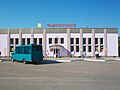
Bus station

Bilopillia railway station

School in Bilopillia


References[]
- ^ "Чисельність наявного населення України (Actual population of Ukraine)" (PDF) (in Ukrainian). State Statistics Service of Ukraine. Retrieved 30 September 2020.
- ^ Белополье // Большая Советская Энциклопедия. / под ред. А. М. Прохорова. 3-е изд. том 3. М., «Советская энциклопедия», 1970. стр.125
- ^ Всесоюзная перепись населения 1989 г. Численность городского населения союзных республик, их территориальных единиц, городских поселений и городских районов по полу
- ^ Чисельність наявного населення України на 1 січня 2013 року. Державна служба статистики України. Київ, 2013. стор.92
- ^ Белополье // Советский энциклопедический словарь. редколл., гл. ред. А. М. Прохоров. 4-е изд. М., «Советская энциклопедия», 1986. стр.124
| show Authority control |
|---|
Coordinates: 51°8′54″N 34°18′3″E / 51.14833°N 34.30083°E
This article about a location in Sumy Oblast is a stub. You can help Wikipedia by . |
- Cities in Sumy Oblast
- Sumskoy Uyezd
- Cities of district significance in Ukraine
- Ukraine geography stubs