Birkweiler
Birkweiler | |
|---|---|
 Coat of arms | |
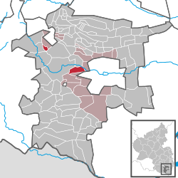
show Location of Birkweiler within Südliche Weinstraße district | |
 Birkweiler | |
| Coordinates: 49°12′21″N 8°02′11″E / 49.20583°N 8.03639°ECoordinates: 49°12′21″N 8°02′11″E / 49.20583°N 8.03639°E | |
| Country | Germany |
| State | Rhineland-Palatinate |
| District | Südliche Weinstraße |
| Municipal assoc. | Landau-Land |
| Government | |
| • Mayor (2019–24) | Bernd Flaxmeyer[1] |
| Area | |
| • Total | 4.99 km2 (1.93 sq mi) |
| Elevation | 189 m (620 ft) |
| Population (2020-12-31)[2] | |
| • Total | 694 |
| • Density | 140/km2 (360/sq mi) |
| Time zone | UTC+01:00 (CET) |
| • Summer (DST) | UTC+02:00 (CEST) |
| Postal codes | 76831 |
| Dialling codes | 06345 |
| Vehicle registration | SÜW |
| Website | www.birkweiler.de |


Birkweiler is a municipality in the Südliche Weinstraße district, in Rhineland-Palatinate, Germany.
Location[]
The municipality is a typical wine village on the German Wine Route in the Siebelding valley at the foot of the Hohenberg (556 m with an observation tower).

Catholic church of St. Bartholomäus
References[]
- ^ Direktwahlen 2019, Landkreis Südliche Weinstraße, Landeswahlleiter Rheinland-Pfalz, accessed 10 August 2021.
- ^ "Bevölkerungsstand 2020, Kreise, Gemeinden, Verbandsgemeinden". Statistisches Landesamt Rheinland-Pfalz (in German). 2021.
| show Towns and municipalities in Südliche Weinstraße |
|---|
| Authority control |
|---|
This Südliche Weinstraße location article is a stub. You can help Wikipedia by . |
Categories:
- Municipalities in Rhineland-Palatinate
- Südliche Weinstraße
- Südliche Weinstraße geography stubs