Bjerke (borough)
This article needs additional citations for verification. (March 2013) |
Bydel Bjerke | |
|---|---|
 | |
 Coat of arms | |
 | |
| Country | Norway |
| City | Oslo |
| District | Grorud Valley |
| Area | |
| • Total | 7.72 km2 (2.98 sq mi) |
| Population (2020[1]) | |
| • Total | 33,422 |
| • Density | 4,329/km2 (11,210/sq mi) |
| Time zone | UTC+1 (CET) |
| • Summer (DST) | UTC+2 (CEST) |
| ISO 3166 code | NO-030109 |
| Website | bbj.oslo.kommune.no |
Bjerke is a borough of the city of Oslo, Norway.
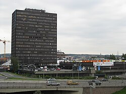
The most densely populated residential areas, including the high-rise apartment blocks of Linderud, are located along Trondheimsveien (Norwegian National Road 4). The shopping centre at Linderud is also home to the borough council's administrative headquarters. The northern areas of the borough are bordered by the vast woodlands of Oslomarka. Bjerke Upper Secondary School is located here.
Districts[]
- Linderud
- (on the border with Nordre Aker borough)
- Tonsenhagen
- Årvoll
- Veitvet
- Økern
Politics[]
As a borough of Oslo, Bjerke is governed by the city council of Oslo as well as its own borough council. The council leader is Lars Fuglesang from the Labour Party and the deputy leader is Hans Husum, of the Socialist Left Party. The Labour Party has the most seats. The 15 seats are distributed among the following political parties for the 2019-2023 term:[2]
- 5 from the Labour Party (Arbeiderpartiet)
- 3 from the Conservative Party (Høyre)
- 2 from the Socialist Left Party (Sosialistisk Venstreparti)
- 2 from the Green Party (Miljøpartiet de Grønne)
- 1 from the Progress Party (Fremskrittspartiet)
- 1 from the Liberal Party (Venstre)
- 1 from the Red Party (Rødt)
References[]
- ^ Municipality of Oslo (2020). "Befolkningen etter bydel, kjønn og aldersgrupper 1.1.2020" (in Norwegian). Retrieved 29 April 2020.
- ^ "Valgresultater valg til bydelsutvalg 2019". Oslo kommune (in Norwegian). Retrieved 2020-05-23.
Coordinates: 59°56′25″N 10°48′50″E / 59.94028°N 10.81389°E

This Oslo location article is a stub. You can help Wikipedia by . |
- Boroughs of Oslo
- Oslo geography stubs