Black Mountain (Georgia)
For other mountains with the same name, see Black Mountain. Should not be confused with Black Mountain, Union County, Georgia.
| Black Mountain | |
|---|---|
 Black Mountain, viewed from Gilmer County | |
| Highest point | |
| Elevation | 3600+ ft (1097+ m) NGVD 29[1] |
| Prominence | 400 ft (120 m)[1] |
| Listing | Mountains of Georgia |
| Coordinates | 34°36′48″N 84°12′17″W / 34.6134228°N 84.2046383°WCoordinates: 34°36′48″N 84°12′17″W / 34.6134228°N 84.2046383°W[2] |
| Geography | |
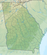 Black Mountain Location of Black Mountain in Georgia | |
| Location | Lumpkin / Gilmer counties, Georgia U.S. |
| Parent range | Georgia Blue Ridge Mountains |
| Topo map | USGS Nimblewill |

Black Mountain is located in Georgia USA on the boundary between Dawson and Gilmer counties. The summit is the highest point in Dawson County. It is in the Chattahoochee National Forest and is part of the Blue Ridge Wildlife Management Area.
Geography[]
Black Mountain is located on the border of Dawson and Gilmer counties. Its elevation is about 3,600 feet.[1] The mountain is located about 4 miles north of Amicalola Falls State Park, 14 miles northwest of Dahlonega and 17 miles southwest of Ellijay.[3] Springer Mountain, the southern terminus of the Appalachian Trail, is located about 1 mile (1.6 km) northeast of Black Mountain.[1] Other nearby geographical features include Nimblewill Gap, Frosty Mountain and Tickanetley Creek.[3][1]
Hiking[]
Black Mountain can be reached via the Appalachian Approach Trail. It is a 5.5-mile (8.9 km) hike north from Amicalola Falls State Park, a 0.6-mile (0.97 km) hike north from Nimblewill Gap, and a 2.3-mile (3.7 km) hike south from Springer Mountain on the trail.[4]
References[]
- ^ Jump up to: a b c d e "Black Mountain, Georgia". Peakbagger.com. Retrieved 6 February 2021.
- ^ "Black Mountain". Geographic Names Information System. United States Geological Survey. Retrieved 6 February 2021.
- ^ Jump up to: a b United States Geological Survey (10 May 2016). Nimblewill, GA quadrangle (Topographic map). Reston, VA: United States Geological Survey. Retrieved 10 May 2016 – via TopoQuest.
- ^ "AT Approach Trail: Hiking Amicalola Falls to Springer Mountain". atlantatrails.com. Retrieved 25 May 2016.
External links[]
| Wikimedia Commons has media related to Black Mountain (Georgia). |
- "Georgia's Named Peaks - Dawson County". Archived from the original on 27 September 2007.
This Dawson County, Georgia state location article is a stub. You can help Wikipedia by . |
This Gilmer County, Georgia state location article is a stub. You can help Wikipedia by . |
- Mountains of Georgia (U.S. state)
- Landforms of Dawson County, Georgia
- Mountains of Gilmer County, Georgia
- Chattahoochee-Oconee National Forest
- Atlanta Metropolitan Area geography stubs
- North Georgia geography stubs