Blackfordby

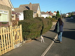
Blackfordby is a small village in the northwesternmost corner of Leicestershire about 2 miles (3.2 km) to the northwest of Ashby-de-la-Zouch and 2 miles southeast of Swadlincote in central England. On some early maps, such as one dated 1587, the village is shown as "Blaugherby", hence the local name of "Blofferby". The village is dominated by the Church of St Margaret of Antioch, Blackfordby, erected in 1858 on the site of an earlier Anglican Chapel which was attached to the St Helen's Church, Ashby-de-la-Zouch. The church stands in an elevated position next to the village school, and is built in the early English style.[1] The church has a nave and chancel, with a tower surmounted by a broach spire and, for the greater part of the work, constructed from local sandstone which has become blackened due to the effects of air pollution.
Until recent years there were several 16th & 17th century thatched cottages in and around the village, but now only two remain, one on Main Street, and one behind the "Rec". Both are now protected buildings.
For many years the population remained at about 500, mainly agricultural workers, until the advent of the "Pits & Pipeworks". It is still a fairly quiet, rural village, although the population has greatly expanded in recent years. Council houses were built in 1948 and 1950, but the biggest changes have been brought about by private development. The village school still survives and has been extended to allow children to continue their education there until they are eleven years old. There were two pubs, The Black Lion and The Blue Bell, but no shops or Post Office. Now only one pub remains. The Black Lion.
Toponymy[]
The village's name means 'farm/settlement with a dark-coloured ford'.[2]
History[]
Charles Abney Hastings of Willesley Hall died on 30 July 1858, aged 66. By a deed of settlement, executed about 1846, the Blackfordby and Packington estates of Sir Charles passed to the Marquis of Hastings, who was Henry Rawdon-Hastings.[3]
References[]
| Wikimedia Commons has media related to Blackfordby. |
- ^ "Blackfordby St. Margaret Parish Page". Freepages Ancestry.com. Archived from the original on 3 November 2012. Retrieved 12 March 2011.
- ^ "Key to English Place-names". kepn.nottingham.ac.uk. Archived from the original on 10 August 2021. Retrieved 14 August 2021.
- ^ "The Gentleman's Magazine", 1858, accessed 12 July 2008
Coordinates: 52°45′29″N 1°30′47″W / 52.758°N 1.513°W
- Villages in Leicestershire
- North West Leicestershire District
- Ashby-de-la-Zouch
- Leicestershire geography stubs

