Blandouet
Blandouet | |
|---|---|
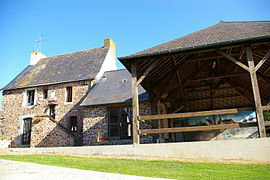
Part of Blandouet-Saint Jean | |
 The town hall in Blandouet | |
 Coat of arms | |
show Location of Blandouet | |
 Blandouet | |
| Coordinates: 48°03′07″N 0°19′39″W / 48.0519°N 0.3275°WCoordinates: 48°03′07″N 0°19′39″W / 48.0519°N 0.3275°W | |
| Country | France |
| Region | Pays de la Loire |
| Department | Mayenne |
| Arrondissement | Laval |
| Canton | Meslay-du-Maine |
| Commune | Blandouet-Saint Jean |
| Area 1 | 11.33 km2 (4.37 sq mi) |
| Population (2017)[1] | 188 |
| • Density | 17/km2 (43/sq mi) |
| Time zone | UTC+01:00 (CET) |
| • Summer (DST) | UTC+02:00 (CEST) |
| Postal code | 53270 |
| Elevation | 88–225 m (289–738 ft) (avg. 160 m or 520 ft) |
| 1 French Land Register data, which excludes lakes, ponds, glaciers > 1 km2 (0.386 sq mi or 247 acres) and river estuaries. | |


Blandouet is a former commune in the Mayenne department in northwestern France. On 1 January 2017, it was merged into the new commune Blandouet-Saint Jean.[2]
Population[]
| Year | Pop. | ±% |
|---|---|---|
| 1793 | 535 | — |
| 1800 | 413 | −22.8% |
| 1806 | 524 | +26.9% |
| 1821 | 518 | −1.1% |
| 1831 | 535 | +3.3% |
| 1836 | 569 | +6.4% |
| 1841 | 585 | +2.8% |
| 1846 | 600 | +2.6% |
| 1851 | 588 | −2.0% |
| 1856 | 568 | −3.4% |
| 1861 | 539 | −5.1% |
| 1866 | 526 | −2.4% |
| 1872 | 454 | −13.7% |
| 1876 | 459 | +1.1% |
| 1881 | 440 | −4.1% |
| 1886 | 431 | −2.0% |
| 1891 | 414 | −3.9% |
| 1896 | 459 | +10.9% |
| 1901 | 444 | −3.3% |
| 1906 | 359 | −19.1% |
| 1911 | 369 | +2.8% |
| 1921 | 295 | −20.1% |
| 1926 | 262 | −11.2% |
| 1931 | 250 | −4.6% |
| 1936 | 259 | +3.6% |
| 1946 | 274 | +5.8% |
| 1954 | 240 | −12.4% |
| 1962 | 220 | −8.3% |
| 1968 | 208 | −5.5% |
| 1975 | 169 | −18.8% |
| 1982 | 159 | −5.9% |
| 1990 | 151 | −5.0% |
| 1999 | 157 | +4.0% |
| 2006 | 189 | +20.4% |
| 2009 | 198 | +4.8% |
See also[]
- Communes of Mayenne
References[]
- ^ Téléchargement du fichier d'ensemble des populations légales en 2017, INSEE
- ^ Arrêté préfectoral 2 June 2016 (in French)
| Wikimedia Commons has media related to Blandouet. |
This Mayenne geographical article is a stub. You can help Wikipedia by . |
Categories:
- Former communes of Mayenne
- Mayenne geography stubs