Blaufelden
show This article may be expanded with text translated from the corresponding article in German. (February 2009) Click [show] for important translation instructions. |
Blaufelden | |
|---|---|
 Coat of arms | |
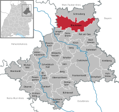
show Location of Blaufelden within Schwäbisch Hall district | |
 Blaufelden | |
| Coordinates: 49°17′49″N 09°58′19″E / 49.29694°N 9.97194°ECoordinates: 49°17′49″N 09°58′19″E / 49.29694°N 9.97194°E | |
| Country | Germany |
| State | Baden-Württemberg |
| Admin. region | Stuttgart |
| District | Schwäbisch Hall |
| Government | |
| • Mayor | Klaus Köger (Ind.) |
| Area | |
| • Total | 90.18 km2 (34.82 sq mi) |
| Elevation | 460 m (1,510 ft) |
| Population (2020-12-31)[1] | |
| • Total | 5,298 |
| • Density | 59/km2 (150/sq mi) |
| Time zone | UTC+01:00 (CET) |
| • Summer (DST) | UTC+02:00 (CEST) |
| Postal codes | 74572 |
| Dialling codes | 07953 |
| Vehicle registration | SHA |
| Website | www.blaufelden.de |


Blaufelden is a municipality in the district of Schwäbisch Hall in Baden-Württemberg in Germany.
References[]
- ^ "Bevölkerung nach Nationalität und Geschlecht am 31. Dezember 2020". Statistisches Landesamt Baden-Württemberg (in German). June 2021.
| show Towns and municipalities in Schwäbisch Hall (district) |
|---|
| Authority control |
|---|
This Schwäbisch Hall district location article is a stub. You can help Wikipedia by . |
Categories:
- Municipalities in Baden-Württemberg
- Schwäbisch Hall (district)
- Stuttgart region geography stubs