Blennerhasset and Torpenhow
This article needs additional citations for verification. (June 2009) |
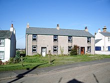
Blennerhasset and Torpenhow (locally /blɛnˈreɪsɪt/ and /trəˈpɛnə/) is a civil parish in the Allerdale district of Cumbria, England. According to the 2001 census it had a population of 437, reducing to 423 at the 2011 Census.[1] It includes the villages of Blennerhasset grid reference NY178415 and Torpenhow at NY202397 and the smaller settlement of Kirkland Guards at NY187401. It is located just outside the Lake District National Park. Baggrow railway station was immediately north of Blennerhasset.[2]
 WikiMiniAtlas
The local pronunciation of Torpenhow is trə-PEN-ə, rather than the more intuitive TOR-pen-how (/ˈtɔːrpənhaʊ/).[3][4] Blennerhasset is pronounced blen-RAY-sit (/blɛnˈreɪsɪt/) instead of BLEN-ər-hass-it (/ˈblɛnərhæsɪt/) as would be expected outside of Cumbria.
St Michael's Church, Torpenhow has a Norman chancel arch with a remarkable carving of interlocking human figures, and a painted wooden ceiling.
Toponymy[]
Blennerhasset is of uncertain etymology, one possible source is that it comes from the Old Norse heysætr 'hay shieling', which has been added to a Brythonic place-name containing blaen, 'top'. The -er- part in the middle " is asserted by Ekwall[5] on the supposition that the full first element corresponded to Welsh blaen-dre, 'hill farm' ".[6] However sæt is also found in place names of Old English origin as a term for a settlement and may also be influenced by Old English sīde. 'Hay' is also found in Old English in both placenames and literary sources with a variety of different spellings and variations such as hēg, hīeg, hīg, hew, heġe and ġehæġ along with Middle English haye and heye. These words range in modern translation as being Hay, Hedge and referring to open plains, fields or farms.
Interpretations of Torpenhow have developed over time. In Place-Names of Cumberland (1950) Torpenhow was etymologized as "Tosti's howe" (with howe deriving from Old Norse haugr 'hill, mound'),[7] against a tradition identifying the name as an example of tautology in place-names, first proposed by Denton (1688).[8] Denton interpreted tor, pen and how as three elements all with the base meaning "hill".[9] Ekwall's Concise Oxford Dictionary of English Place-names (4th ed. 1960) accepted Denton's torr+pen+howe etymology (against the 1950s "Tosti" proposal), but notes that torr+penn is not tautological. He expresses the idea of "top or breast of the hill", to which howe was added in a (single) tautology.[10] The most recent published etymology is the '"[r]ocky summit" to which was added "hill-spur"', the three elements of Torpenhow deriving from, Old English torr 'a rock, a rocky outcrop, a rocky peak', Primitive Welsh penn 'head, end, top, height, a hill', and Old English hōh 'a heel; a sharply projecting piece of ground'.[11]
The local pronunciation of Torpenhow Village is /trəˈpɛnə/, though the more intuitive pronunciation /ˈtɔːrpənhaʊ/ is also used.[4]
Governance[]
Blennerhasset and Torpenhow is part of the Workington constituency of the UK parliament. The current Member of Parliament is Mark Jenkinson, a member of the Conservative Party. Prior to the 2019 general election, the Labour Party had won the seat in every general election since 1979; the Conservative Party had previously only been elected once in Workington since the Second World War: in the 1976 Workington by-election.[12]
For local government purposes it is in the Boltons ward of Allerdale Borough Council, which is represented by Malcolm Grainger (Conservative), and the Bothel and Wharrels ward of Cumbria County Council, which is represented by Joseph Bowness (Conservative).
Its parish council is Blennerhasset and Torpenhow Parish Council.[13]
Blennerhasset Mill[]
Blennerhasset Mill (at grid reference NY1844041890) is on the south bank of the River Ellen.
Roman fort[]
A Roman fort[14] is situated on the old Roman Road between Old Carlisle grid reference NY263466 and Papcastle grid reference NY109314
See also[]
References[]
| Wikimedia Commons has media related to Blennerhasset and Torpenhow. |
- ^ "Parish population 2011". Retrieved 19 June 2015.
- ^ 1860 Ordnance Survey map
- ^ "Pardon? Where did you say that was?". BBC. Retrieved 1 Feb 2020.
- ^ a b Francis, Darryl (2003). "The Debunking of Torpenhow Hill". Word Ways. 36 (1): 6–8.
- ^ Ekwall, Eilert (1922). The place-names of Lancashire. Manchester: Chetham Society.
- ^ Armstrong, A. M.; Mawer, A.; Stenton, F. M.; Dickens, B. (1950). The place-names of Cumberland. English Place-Name Society, vol.xxi. part 2. Cambridge: Cambridge University Press. pp. 265–66.
- ^ Armstrong, 1950, p.266
- ^ Thomas Denton: A Perambulation of Cumberland, 1687-8, including descriptions of Westmorland, the Isle of Man and Ireland
- ^ Denton apprarently exaggerated the example to a "Torpenhow Hill", which would quadruple the "hill" element, but the existence of a toponym "Torpenhow Hill" is not substantiated. Francis, Darryl (2003). "The Debunking of Torpenhow Hill". Word Ways. 36 (1): 6–8.
- ^ the same etymology is also accepted y David Mills, 2011, A Dictionary of British Place-Names.
- ^ English, University of Nottingham - Institute of Name Studies School of. "Key to English Place-names". kepn.nottingham.ac.uk. Retrieved 2018-06-20.
- ^ "A vision of Britain website – general elections section". Retrieved 27 April 2012.
- ^ "Blennerhasset and Torpenhow Parish Council".
- ^ Roman Britain Archived 2007-07-14 at the Wayback Machine
External links[]
- Cumbria County History Trust: Blennerhasset and Kirkland (nb: provisional research only - see Talk page)
- Cumbria County History Trust: Torpenhow and Whitrigg (nb: provisional research only - see Talk page)
- Civil parishes in Cumbria
- Allerdale
- Roman sites in Cumbria