Blindheim
Blenheim
Blindheim | |
|---|---|
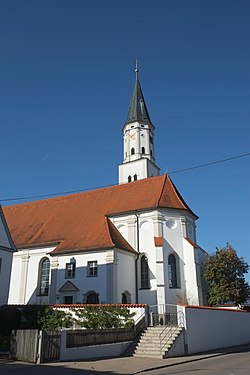 Church of Saint Martin | |
 Coat of arms | |
show Location of Blenheim within Dillingen district | |
 Blenheim | |
| Coordinates: 48°37′54″N 10°37′07″E / 48.63167°N 10.61861°ECoordinates: 48°37′54″N 10°37′07″E / 48.63167°N 10.61861°E | |
| Country | Germany |
| State | Bavaria |
| Admin. region | Schwaben |
| District | Dillingen |
| Government | |
| • Mayor (2020–26) | Jürgen Frank[1] |
| Area | |
| • Total | 26.39 km2 (10.19 sq mi) |
| Elevation | 415 m (1,362 ft) |
| Population (2020-12-31)[2] | |
| • Total | 1,756 |
| • Density | 67/km2 (170/sq mi) |
| Time zone | UTC+01:00 (CET) |
| • Summer (DST) | UTC+02:00 (CEST) |
| Postal codes | 89434 |
| Dialling codes | 09074 |
| Vehicle registration | DLG |
| Website | www.blindheim.de |


Blindheim (German: [ˈblɪnthaɪm]), traditionally known in English as Blenheim (/ˈblɛnɪm/ BLEN-im), is a municipality in the Bavarian district of Dillingen in southern Germany, consisting of several villages. It is north of Augsburg, on the left bank of the Danube River. Its population is roughly 1,700.
For administrative purposes, it is affiliated with the municipal association of Höchstädt an der Donau.
Since about 1700 the Lordship of Blindheim in the Electorate of Bavaria has been held by the Counts of Rechberg.
On 13 August 1704 the Battle of Blenheim (German: Schlacht von Höchstädt) was fought in the vicinity, having decisive importance on the War of Spanish Succession. Blenheim Palace in England was named in memory of the battle, and thus ultimately after Blindheim.
In June 1800, the armies of the French First Republic, under command of Jean Victor Moreau, fought Habsburg regulars and Württemberg contingents, under the general command of Pál Kray. At this battle, the culmination of the Danube Campaign of 1800, Moreau forced Kray to abandon Ulm and withdraw into eastern Bavaria.[3]
See also[]
References[]
- ^ Liste der ersten Bürgermeister/Oberbürgermeister in kreisangehörigen Gemeinden, Bayerisches Landesamt für Statistik, 15 July 2021.
- ^ "Tabellenblatt "Daten 2", Statistischer Bericht A1200C 202041 Einwohnerzahlen der Gemeinden, Kreise und Regierungsbezirke". Bayerisches Landesamt für Statistik (in German). June 2021.
- ^ "Höchstädt", History of the Wars of the French Revolution: Including Sketches of the Civil History of Great Britain and France, from the Revolutionary Movements, 1788, to the Restoration of a General Peace, 1815, Kuhl, France, 1820, p. 183.
External links[]
- Official website of the Municipality of Blindheim (in German)
- Google Earth view of Blindheim and around
| show Towns and municipalities in Dillingen (district) |
|---|
| show Authority control |
|---|
This Bavaria location article is a stub. You can help Wikipedia by . |
- Municipalities in Bavaria
- Dillingen (district)
- Bavaria geography stubs