Blokktinden
| Blokktinden | |
|---|---|
| Blokktind | |
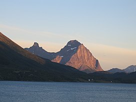 Blokktinden seen from Halsa in Meløy Municipality | |
| Highest point | |
| Elevation | 1,032 m (3,386 ft) |
| Prominence | 674 m (2,211 ft) |
| Coordinates | 66°39′08″N 13°26′03″E / 66.6522°N 13.4343°ECoordinates: 66°39′08″N 13°26′03″E / 66.6522°N 13.4343°E[1] |
| Geography | |
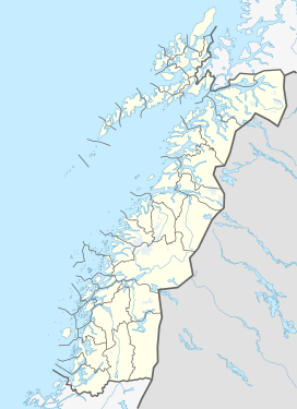 Blokktinden Location of the mountain | |
| Location | Nordland, Norway |
| Parent range | Saltfjellet |
| Topo map | 1928 III Melfjorden |


Blokktinden or Blokktind is a mountain in the municipality of Rødøy in Nordland county, Norway.[1] It is located on the southern side of Tjongsfjorden, across from the village of Tjong. The summit has a good view of the Svartisen glacier and the coastal islands.
Name[]
The first element is blokk which means "block" or "mountain that consists of one single rock". The last element is the finite form of tind which means "mountain peak".
References[]
- ^ a b "Blokktinden, Rødøy (Nordland)" (in Norwegian). yr.no. Retrieved 2018-06-17.
This article about a mountain, mountain range, or peak in Nordland is a stub. You can help Wikipedia by . |
Categories:
- Rødøy
- Mountains of Nordland
- Norway mountain stubs
- Nordland geography stubs