Blue Lake (Alaska)
| Blue Lake | |
|---|---|
 Blue Lake Dam spillway in Sitka Alaska | |
 Blue Lake | |
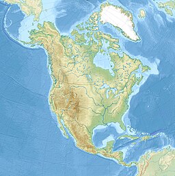
| Location | Baranof Island, Sitka City and Borough, Alaska |
| Coordinates | 57°04′24″N 135°09′46″W / 57.07333°N 135.16278°WCoordinates: 57°04′24″N 135°09′46″W / 57.07333°N 135.16278°W[1] |
| Type | Reservoir |
| Primary inflows | Blue Lake Valley Creek |
| Primary outflows | Sawmill Creek |
| Basin countries | United States |
| Max. length | 3 mi (4.83 km)[1] |
| Surface area | 1,225 acres (5 km2) |
| Max. depth | 468 ft (143 m) |
| Surface elevation | 436 ft (133 m)[1] |
| References | [1][2] |
Blue Lake (Tlingit: Gajook Héen Yik.áayi[3]) is a 3 miles (4.8 km) long reservoir located 6 miles (9.7 km) east of the town of Sitka, on the west side of Baranof Island, in the Alexander Archipelago of Southeast Alaska.[1]
Name and geology[]
The local descriptive name was reported in 1910 by Knopf (1912, fig 4), in United States Geological Survey.[1]
Blue Lake, as its name suggests, possesses a deep blue hue to its water. Blue Lake's water sources are partially from snowpack and small glaciers from the glacially carved, U-shaped, Blue Lake valley in which it lies.
Dam[]
Blue lake was first dammed in 1913 by Sitka Wharf and Power Company. It sold its operation to the city in 1942. Floods damaged the infrastructure in 1943 and 1947.[4]
Blue Lake was dammed again in 1958, greatly expanding the lake's size from 490 acres (2.0 km2) to 1,225 acres (5 km2) and increasing its height from 208 ft (63 m) to 342 ft.[5] Dam fluctuations allow the lake elevation to vary up to 60 ft (18 m). The Blue Lake dam, along with the Green Lake Dam, combine to make Sitka's mainstream power sources exclusively hydroelectric.
Blue Lake Road is used to reach the lake from Sawmill Cove, allowing residents to use kayaks and canoes to more easily access peaks further up the Blue Lake valley, like Clarence Kramer Peak. Blue Lake Campground lies along this road. The road itself is very dangerous, often winding above cliff ledges. There are also many avalanche chutes located along the road which can pose a hazard or block it completely in winter.
Water rights[]
Currently, at the , there is a small water bottling operation utilizing the water that originates from the watershed. Two other companies retain rights to export of the water in the future. In 2010 a Texas company announced that it was moving forward with a plan to ship 2.9 to 9 billion US gallons (11,000,000 to 34,000,000 m3) of fresh lake water a year from Blue Lake to the west coast of India.[6] The deal would represent the world's first regular, bulk exports of water via tanker.[7] The water will be redistributed to places in India, southeast Asia and the Middle East. The town of Sitka could earn up to $90 million a year in revenue.[7]
References[]
- ^ a b c d e f U.S. Geological Survey Geographic Names Information System: Blue Lake (Alaska)
- ^ "Lake Water Quality Records and Lake Levels - Southeast Alaska" (PDF). USGS. 2002-12-18. p. 1. Archived from the original (PDF) on 2006-10-11. Retrieved 2007-05-27.
- ^ Joseph, Charlie; Brady, I.; Makinen, E.; David, R.; Davis, V.; Johnson, A.; Lord, N. (2001). "Sheet'kwaan Aani Aya". Sitka Tribe of Alaska. Archived from the original on 25 July 2008. Retrieved 27 October 2009.
- ^ "Historical Society and Museum Hold Annual Meeting". Sitka Daily Sentinel. Sitka, United States. 25 October 2012. Retrieved 26 October 2012.
- ^ "Blue Lake Hydroelectric Project" (PDF). City of Sitka. November 2002. p. 9. Archived from the original (PDF) on 2007-02-03. Retrieved 2007-05-27.
- ^ "S2C GLOBAL ANNOUNCES INDIA WORLD WATER HUB" Archived 2010-07-15 at the Wayback Machine, July 7, 2010.
- ^ a b "Alaska City Set to Ship Water to India, U.S. Company Announces", Circle of Blue, July 11, 2010
- Reservoirs in Alaska
- Lakes of Sitka, Alaska
- Buildings and structures in Sitka, Alaska
- Protected areas of Sitka, Alaska

