Boistfort Peak
| Boistfort Peak | |
|---|---|
 Boistfort Peak | |
| Highest point | |
| Elevation | 3,113 ft (949 m) NAVD 88[1] |
| Prominence | 2,680 ft (820 m)[2] |
| Coordinates | 46°29′17″N 123°12′55″W / 46.488145508°N 123.215308036°WCoordinates: 46°29′17″N 123°12′55″W / 46.488145508°N 123.215308036°W[1] |
| Geography | |
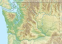
| Location | Lewis County, Washington, U.S. |
| Parent range | Willapa Hills, Pacific Coast Ranges |
| Topo map | USGS Boistfort Peak |

Boistfort Peak, also called Baw Faw Peak, is a peak in the Willapa Hills in Washington state. The summit was once the site of a fire lookout and is the highest point in the Willapa Hills.[3] Today it has communication antennae including the WA7UHD 2-meter ham repeater. It also is the site of station BOW in the Pacific Northwest Seismic Network.[4]
References[]
- ^ a b "Baw Faw". NGS data sheet. U.S. National Geodetic Survey. Retrieved 2008-12-03.
- ^ "Boistfort Peak, Washington". Peakbagger.com. Retrieved 2008-12-03.
- ^ "Baw Faw (Boistfort) Lookout". Rex's Forest Fire Lookout Page. Retrieved 2008-12-03.
- ^ "Webicorder Maps". The Pacific Northwest Seismic Network. Archived from the original on 2008-12-16. Retrieved 2008-12-03.
External links[]
- "Boistfort Peak". Geographic Names Information System. United States Geological Survey. Retrieved 2008-12-03.
- "Baw Faw Repeater Group". Archived from the original on 2008-08-20. Retrieved 2008-12-03.
This Lewis County, Washington state location article is a stub. You can help Wikipedia by . |
Categories:
- Mountains of Lewis County, Washington
- Mountains of Washington (state)
- Washington (state) geography stubs