Bonham Road
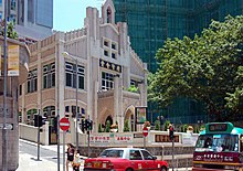
 View of Bonham Road facing St. Anthony's Church | |||
| Length | 1.3 km (0.8 mi) | ||
|---|---|---|---|
| Area | Sai Ying Pun/Mid-Levels | ||
| West end | Pok Fu Lam Road, Hill Road | ||
| East end | Caine Road | ||
| Bonham Road | |||||||||||||
|---|---|---|---|---|---|---|---|---|---|---|---|---|---|
| Chinese | 般咸道 般含道 | ||||||||||||
| |||||||||||||
Bonham Road is a main road in West Mid-Levels, Hong Kong Island in Hong Kong, running mainly East-West. The road connects Pok Fu Lam Road in the west, near the University of Hong Kong, and Caine Road in the east, at the junction with Hospital Road and . It was named after Sir George Bonham, the third Governor of Hong Kong.[1] It was renamed Nishi-Taisho Dori (西大正通) during Japanese occupation of Hong Kong.
Features[]
Several historical buildings are located on the road, including Fung Ping Shan building, Hung Hing Ying building and the Main Building of The University of Hong Kong. There are also a few well known schools located on the road, including King's College, St. Paul's College, Hong Kong, St. Stephen's Girls' College, St. Clare's Primary School, Bonham Road Government Primary School, which is there in the 19th century.
Bonham Road Flyover[]
Bonham Road Flyover is a one-way, single-lane flyover allowing vehicles travelling north on Pok Fu Lam Road to turn east onto Bonham Road. It was completed in 1973.
Landmarks[]
Community Facilities[]
Transport[]
Education[]
- University of Hong Kong
- St. Stephen's Girls' College
- King's College, Hong Kong
- St. Paul's College, Hong Kong
- St. Stephen's Church College
- Bonham Road Government Primary School
Religious[]
- Hop Yat Church (Hong Kong)
Nature[]
Military[]
- 88 Bonham Road - Western Barracks (Bonham Tower Barracks) of the Hong Kong Garrison
Intersecting roads[]
Listed from West to East:
- Pok Fu Lam Road
- Hill Road
- (Private Road)
- Western Street
- Centre Street (pedestrianised)
- Breezy Path
- Hospital Road
- Caine Road
See also[]
References[]
- ^ Yanne, Andrew; Heller, Gillis (2009). Signs of a Colonial Era. Hong Kong University Press. pp. 45–46. ISBN 9789622099449.
External links[]
| Wikimedia Commons has media related to Bonham Road. |
Coordinates: 22°17′03″N 114°08′33″E / 22.2842°N 114.1424°E

This Hong Kong road article is a stub. You can help Wikipedia by . |
- Roads in Hong Kong
- Sai Ying Pun
- Hong Kong road stubs