Borová (Náchod District)
This article does not cite any sources. (March 2016) |
Borová | |
|---|---|
Municipality and village | |
 | |
 Flag  Coat of arms | |
| Coordinates: 50°23′02″N 16°15′14″E / 50.3838888889°N 16.2538888889°ECoordinates: 50°23′02″N 16°15′14″E / 50.3838888889°N 16.2538888889°E | |
| Country | |
| Region | Hradec Králové Region |
| District | Náchod District |
| Area | |
| • Total | 1.19 sq mi (3.07 km2) |
| Elevation | 2,008 ft (612 m) |
| Population (1.1.1021) | |
| • Total | 211 |
| • Density | 180/sq mi (69/km2) |
| Time zone | UTC+1 (CET) |
| • Summer (DST) | UTC+2 (CEST) |

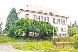
Borová is a village and municipality in Náchod District in the Hradec Králové Region of the Czech Republic. It is located near the border with Poland.
| Wikimedia Commons has media related to Borová (Náchod District). |
| Authority control: National libraries |
|---|
This Hradec Králové Region location article is a stub. You can help Wikipedia by . |
Categories:
- Populated places in Náchod District
- Villages in Náchod District
- Hradec Králové Region geography stubs