Botala
This article does not cite any sources. (March 2014) |
Botala بوتالہ | |
|---|---|
Village and union council | |
 | |
| Country | Pakistan |
| Region | Punjab Province |
| District | Khushab District |
| Population | |
| • Total | 36,000 |
| Time zone | UTC+5 (PST) |
Botala (Urdu: بوتالہ), is a village and one of the 51 Union Councils of Khushab District in the Punjab Province of Pakistan. It is situated 3.5 km south from the main Mianwali-Lahore road. It is about 12 kilometers distance from district headquarters Jauahrabad and 60 kilometers from divisional headquarters Sargodha.
Areas[]
- Area: about 10,000 acres (40 km2).
- : Pindi, Jhugi Manday Wali, Handan Wala, Balkian Aala Boad, Neher Pul Jabbi
- : Tapian, Gada Maar, Jhugi Manday Wali, Hadan Wala, Shero, Kamoon
Population[]
Population is about 36,000.
Geography[]
The lands of the village are fertile with 98% irrigated areas and 2% desert.
Economy[]
- Crops: The major crops of botala are sugarcane, rice, wheat, etc.
- : There are 5 major canals in the lands of Botala. Hundreds of water courses are lying there.
- Deserts: The great Thal Desert starts from Botala and its native town Hadali as well.
Photo gallery[]
Botala, Khushab
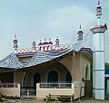
Masjid @ Botala Adda

Hotel @ Botala Adda
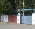
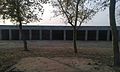
Govt Elementary School for Boys, Botala
Govt Elementary School for Girls, Botala
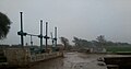
Head, Botala
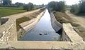
Botala Miner Canal
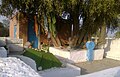
Darbar Baba Qamer Ali, Botala
Janaza Gah, Botala

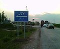
View of Botala Adda
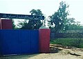
Botala Entrance

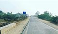
Botala-42 chak road


References[]
External links[]
![]() Media related to Botala at Wikimedia Commons
Media related to Botala at Wikimedia Commons
Administrative divisions of Khushab District | ||
|---|---|---|
| Capital |  | |
| Tehsils | ||
| Towns |
| |
| Union councils |
| |
Categories:
- Union councils of Khushab District
- Populated places in Khushab District