Boyne Valley Township, Michigan
Boyne Valley Township, Michigan | |
|---|---|
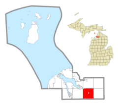 Location within Charlevoix County (red) and the administered village of Boyne Falls (pink) | |
 Boyne Valley Township Location within the state of Michigan | |
| Coordinates: 45°09′51″N 84°54′58″W / 45.16417°N 84.91611°WCoordinates: 45°09′51″N 84°54′58″W / 45.16417°N 84.91611°W | |
| Country | United States |
| State | Michigan |
| County | Charlevoix |
| Government | |
| • Supervisor | Sue Hobbs |
| • Clerk | Lynn Sparks |
| Area | |
| • Total | 35.45 sq mi (91.8 km2) |
| • Land | 34.78 sq mi (90.1 km2) |
| • Water | 0.67 sq mi (1.7 km2) |
| Elevation | 712 ft (217 m) |
| Population (2010) | |
| • Total | 1,195 |
| • Density | 34.4/sq mi (13.3/km2) |
| Time zone | UTC-5 (Eastern (EST)) |
| • Summer (DST) | UTC-4 (EDT) |
| ZIP code(s) | |
| Area code(s) | 231 |
| FIPS code | 26-09860[1] |
| GNIS feature ID | 1625966[2] |
| Website | Official website |

Boyne Valley Township is a civil township of Charlevoix County in the U.S. state of Michigan. As of the 2010 census, the township population was 1,195.[3] The township contains the village of Boyne Falls and the Boyne Mountain ski resort.
Geography[]
The township is located in southeastern Charlevoix County and is bordered by Antrim County to the south. The village of Boyne Falls is located in the center of the township, along the South Branch of the Boyne River. The South Branch and North Branch join north of Boyne Falls, and the resulting Boyne River flows northwest to Boyne City at the southeastern end of Lake Charlevoix.
Boyne Mountain Resort is located on 1,152-foot-high (351 m) Boyne Mountain just west of Boyne Falls.
According to the United States Census Bureau, Boyne Valley Township has a total area of 35.4 square miles (91.8 km2), of which 34.8 square miles (90.1 km2) is land and 0.69 square miles (1.8 km2), or 1.91%, is water.[3]
Demographics[]
As of the census[1] of 2000, there were 1,215 people, 495 households, and 335 families residing in the township. The population density was 34.6 per square mile (13.3/km2). There were 653 housing units at an average density of 18.6 per square mile (7.2/km2). The racial makeup of the township was 97.78% White, 1.56% Native American, 0.16% Asian, 0.08% Pacific Islander, 0.08% from other races, and 0.33% from two or more races. Hispanic or Latino of any race were 0.41% of the population.
There were 495 households, out of which 30.5% had children under the age of 18 living with them, 55.8% were married couples living together, 7.1% had a female householder with no husband present, and 32.3% were non-families. 28.3% of all households were made up of individuals, and 12.1% had someone living alone who was 65 years of age or older. The average household size was 2.44 and the average family size was 3.01.
In the township the population was spread out, with 25.1% under the age of 18, 7.5% from 18 to 24, 29.7% from 25 to 44, 23.1% from 45 to 64, and 14.6% who were 65 years of age or older. The median age was 38 years. For every 100 females, there were 102.2 males. For every 100 females age 18 and over, there were 101.8 males.
The median income for a household in the township was $38,167, and the median income for a family was $45,750. Males had a median income of $35,870 versus $21,944 for females. The per capita income for the township was $16,805. About 3.8% of families and 6.4% of the population were below the poverty line, including 6.7% of those under age 18 and 7.3% of those age 65 or over.
Transportation[]
Airports[]
- Boyne Mountain Airport is located southwest of the US-131 and M-75 intersection. The airport is privately owned and operated by Boyne Resorts. The airport supports a 5,200-foot paved and lighted jet strip, and permits instrument approach landing.
Major highways[]
 US 131 enters the township from the south, passes through Boyne Falls and then exits the township at its northern boundary. It leads north 15 miles (24 km) from Boyne Falls to Petoskey on the shore of Lake Michigan's Little Traverse Bay and southwest 35 miles (56 km) to Kalkaska.
 C-48 enters the township from the east as Thumb Lake Road and intersects US 131 at Boyne Falls. C-48 then runs concurrently with US 131 from Thumb Lake Road, south, to M-75. C-48 then follows with M-75 in a northwest direction to Deer Lake Road. It then becomes Deer Lake Road, runs southwest along the shore of Deer Lake and exits the township on its western boundary.
 M-75 enters the township from Boyne City in the northwest and travels southeast and terminates at US 131 in Boyne Falls.
Schools[]
- Boyne Falls Public School
- Concord Academy Boyne (charter school)
- Boyne City Alternative Education - Boyne Valley Campus
References[]
- ^ a b "U.S. Census website". United States Census Bureau. Retrieved 2008-01-31.
- ^ U.S. Geological Survey Geographic Names Information System: Boyne Valley Township, Michigan
- ^ a b "Geographic Identifiers: 2010 Demographic Profile Data (G001): Boyne Valley township, Charlevoix County, Michigan". U.S. Census Bureau, American Factfinder. Archived from the original on February 12, 2020. Retrieved September 2, 2014.
Municipalities and communities of Charlevoix County, Michigan, United States | ||
|---|---|---|
| Cities |  | |
| Village | ||
| Civil townships | ||
| CDPs | ||
| Indian reservations | ||
| Footnotes | ‡This populated place also has portions in an adjacent county or counties | |
| ||
- Townships in Charlevoix County, Michigan
- Townships in Michigan