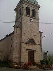
Brénaz
This article may be expanded with text translated from the corresponding article in French. (December 2008) Click [show] for important translation instructions.
|
Brénaz | |
|---|---|
Part of Arvière-en-Valromey | |
 | |
Location of Brénaz  | |
 Brénaz | |
| Coordinates: 45°56′54″N 5°43′22″E / 45.9483°N 5.7228°ECoordinates: 45°56′54″N 5°43′22″E / 45.9483°N 5.7228°E | |
| Country | France |
| Region | Auvergne-Rhône-Alpes |
| Department | Ain |
| Arrondissement | Belley |
| Canton | Hauteville-Lompnes |
| Commune | Arvière-en-Valromey |
| Area 1 | 9.79 km2 (3.78 sq mi) |
| Population (2019)[1] | 105 |
| • Density | 11/km2 (28/sq mi) |
| Time zone | UTC+01:00 (CET) |
| • Summer (DST) | UTC+02:00 (CEST) |
| Postal code | 01260 |
| Elevation | 580–1,425 m (1,903–4,675 ft) (avg. 650 m or 2,130 ft) |
| 1 French Land Register data, which excludes lakes, ponds, glaciers > 1 km2 (0.386 sq mi or 247 acres) and river estuaries. | |


Brénaz is a former commune in the Ain department in eastern France. On 1 January 2019, it was merged into the new commune Arvière-en-Valromey.[2]
Geography[]
The commune lies west of the Grand Colombier (Ain).
Population[]
|
|
See also[]
References[]
- ^ Téléchargement du fichier d'ensemble des populations légales en 2019, INSEE
- ^ Arrêté préfectoral 17 December 2018 (in French)
| Wikimedia Commons has media related to Brénaz. |
This Ain geographical article is a stub. You can help Wikipedia by . |
Categories:
- Former communes of Ain
- Populated places disestablished in 2019
- Ain geography stubs