Brünig Pass
| Brünig Pass | |
|---|---|
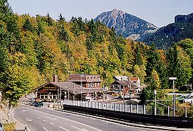 View of the pass, showing the railway station | |
| Elevation | 1,008 m (3,307 ft) |
| Traversed by | Road, rail |
| Location | Bern/Obwalden, Switzerland |
| Range | Alps |
| Coordinates | 46°45′28″N 08°08′16″E / 46.75778°N 8.13778°ECoordinates: 46°45′28″N 08°08′16″E / 46.75778°N 8.13778°E |
 Brünig Pass Location in Switzerland | |

The Brünig Pass, at an altitude of 1,008 m (3,307 ft), connects the Bernese Oberland and central Switzerland, linking Meiringen in the canton of Bern and Lungern in the canton of Obwalden. It is on the watershed between the upper reaches of the Aare, which flows through Lake Brienz and Lake Thun, and the Sarner Aa, which flows into Lake Lucerne.[1][2]
The pass is crossed by the Zentralbahn's Brünig railway line, between Lucerne and Interlaken, and that line's Brünig-Hasliberg station is situated in the pass. The pass is also crossed by the A8 motorway, between Lucerne and Spiez. Both rail and road crossings are normally kept open throughout the winter.[1]
The pass is the starting or finishing point of many hikes. Particularly popular is the route to or from the Brienzer Rothorn, which is accessible by rail at both ends.[2]
The pass is the subject of a watercolour painting by J. M. W. Turner, entitled , and dating from c.1847-8.[3]
See also[]
- List of highest paved roads in Europe
- List of mountain passes
- List of the highest Swiss passes
References[]
- ^ Jump up to: a b map.geo.admin.ch (Map). Swiss Confederation. Retrieved 2013-01-05.
- ^ Jump up to: a b "Brünigpass". Hiking in Switzerland. SwitzerlandMobility. Archived from the original on 2012-05-17. Retrieved 2013-01-06.
- ^ "The Brunig Pass, from Meiringen, Joseph Mallord William Turner". Tate, London. Retrieved 2013-01-06.
External links[]
![]() Media related to Brünig Pass at Wikimedia Commons
Media related to Brünig Pass at Wikimedia Commons
- Brünig Pass in German, French and Italian in the online Historical Dictionary of Switzerland.
- Weather report for the Brünig Pass
| hide Authority control | |
|---|---|
| General |
|
| Other | |
This Canton of Bern location article is a stub. You can help Wikipedia by . |
This Obwalden location article is a stub. You can help Wikipedia by . |
- Mountain passes of Switzerland
- Mountain passes of Obwalden
- Bernese Oberland
- Mountain passes of the canton of Bern
- Bern–Obwalden border
- Rail mountain passes of Switzerland
- Canton of Bern geography stubs
- Switzerland geography stubs